My visit to Lassen Volcanic National Park on a trip south to visit family.

Lassen_Volcanic_National_Park_map

I left Vancouver for southern California and my first overnight stop was Lassen Volcanic National Park in northern California. As the name implies it’s major features are volcanic in origin. Being the southern most volcano of the Cascade Range the prominent features of the park are the largest plug volcano in the world, Lassen Peak and it’s sulfur – thermal hot springs.

7-2


Originally two separate National Monuments dedicated in 1907 by Theodore Roosevelt, Cinder Cone and Lassen Peak National Monuments were declared Lassen Volcanic National Park in 1916.

0-0

I arrived late in the afternoon after an 8 1/2 hour drive and set up camp at Manzanita Lake Campground located in the northern section of the park. Then I proceeded to walk the loop trail around Manzanita Lake, ate dinner and enjoyed a nice campfire before retiring to my tent to read and fall asleep.


Accessible by five vehicle entrances the majority of visitors enter either from the north or south along State Route 89, named the Volcanic Legacy Scenic Byway or Lassen Volcanic National Park Highway, off State route 44 in the north and 89 from the south. Three unpaved roads enter the park but do not connect with the main road through the park, Highway 89.

The north-south 29-mile (46.6k) road, Highway 89, was constructed between 1925 and 1931. The road summit is the highest in the Cascades topping at 8,512 feet (2,594 m). This road is closed in the winter months due to snow, which can reach 40 feet (12.2m) deep.

0-4

Early morning along the Lassen Volcanic National Park Highway


I got up early, had a quick breakfast and packed up to head south along Route 89 to visit the sites of the park. It was very interesting stopping at the many informative signs along the road to read the history of the park.


The last minor to major eruption started in 1914 and lasted until 1921 creating a new crater on Lassen Peak. Releasing ash and lava it fortunately did not kill anyone. This eruption covered many miles of forestlands with landslides and the new growth forest today stands many feet above the old forest floor. These landslides also created Manzanita Lake as it damned Manzanita Creek.

The first blast was on May 19, 1915 and was said to be a night to remember with it’s steam explosion and subsequent mudflows. Had it not been for Elmer Sorahan many people might have died but he ran 3 miles (4.8k) to warn others after escaping the explosion.


Three days later on May 22, 1915 another explosion on Lassen Peak threw ash, pumice, rock and gas into the air that was more devastating to the area than the first. The pressure in the mountain built up like a lid on a boiling pot of water and finally blew. You can now explore this area on a ½ mile (0.8k) loop trail or take the strenuous 2,000 foot (609.6m) 5 mile (8k) round trip hike to the top of 10,457 foot (3,187m) Lassen Peak. Many other hiking opportunities exist in the park along with backpacking, auto-touring, bird watching, camping skiing, skiing, snow play, and snowshoeing.

There are 5 hydrothermal areas to explore within the park. Sulphur Works, Bumpass Hell, Devils Kitchen, Boiling Springs Lake and Thermal Geyser. I am limiting myself to 2 for this trip.

4-4

My first hydrothermal area would have been the hike out to Bumpass Hell Hydrothermal Area, a moderate 3 mile (4.8k) round trip hike. This is the largest hydrothermal area of the park with temperatures of up to 322 degrees F (161 degrees C). I had done this hike with my kids back in the early 1990’s although I found the trail closed this season for maintenance of the trail and boardwalk through the 2018 season.

My next stop was Sulphur Works, a formation of mudpots, steam vents and boiling springs located right off the main road. This hydrothermal area in near the center of a massive composite volcano that collapsed many thousands of years ago. Mount Tehama or Brokeoff Mountain was estimated to be 1,000 feet (304m) higher than Lassen Peak. Active 400,000 to 600,000 years ago it is estimated to be nearly 11 miles (17.7k) across and had towered to 11,500 feet (3,505k).


My final stop was the Kohm Yah-mah-nee Visitor Center at the south entry of the park to visit the small museum learning the history of the park, peoples and area and had a nice talk with the Rangers.

Now for the long 8 hour drive down the east side of the Sierra Nevada Mountains along State highway 395 to the BLM area of Alabama Hills outside of Lone Pine, CA.

Cape Disappointment State Park, WA

Named by Captain John Meares’ 1778 disappointing sailing to find the mouth of the Columbia River for trading. Being turned away by a severe storm, he named this place Cape Disappointment. While in complete contrast Lewis and Clark’ s Corps of Discovery cheered as they completed their journey with their first sight of the Pacific Ocean on a bluff on Cape Disappointment.

“Cape Disappointment Map 07-27-16”

Cape Disappointment State Park is far from being a disappointment. Steeped in Northwest history, it is a place to explore U.S. military and maritime installations, learn more of Lewis & Clark’s Corps of Discovery Expedition and their effects on native tribes of the area. Camp, fish, hike old-growth forests, roam around freshwater lakes, saltwater marshes and ocean tidelands. Marvel at the breathtaking views from the highlands above the sea and wander the beaches that are enjoyed by kite-fliers, beachcombers, sandcastle builders and those who just love to walk. Hike to 2 lighthouses that guided the mariners to the mouth of the river and kept them from becoming victims of the Grave Yard of the Pacific.

Lewis and Clark Interpretive Center

I began my day at the Lewis and Clark Interpretive Center and one of the Battery’s of Fort Canby that defended the entrance to the Columbia River from the mid 1900’s to the end of World War II. The Interpretive center is a museum providing a history lesson of The Corps of Discovery’s journey from settled America along the Mississippi River to the Pacific Ocean. Walk along the history path in its interactive exhibits that will entertain all ages. Sitting right above Battery Harvey Allen of Fort Canby to the inland side and overlooking the Pacific Ocean from its cliff side perch it is a wonderful place to start your visit to the park.

Off to the south from the ocean-viewing platform of the Interpretive Center you see Cape Disappointment Lighthouse. Start the hike to the lighthouse in the Interpretive Center’s parking lot. You’ll walk through dense forest glimpsing ocean and river views as you make your way to the oldest operating lighthouse in the Pacific Northwest. Built in 1856 to warn the ships of the treacherous currents and obstacles of the river bar at the mouth of the river.

Continuing on driving I thought I made a very wrong turn as I saw a sign for Waikiki Beach. It is a short ¼ mile (0.4 k) walk to the beach. It was still overcast when I visited although I suspect it would be a nice place for a picnic lunch and to watch the waters and vessels of the Columbia River float past.

Continuing my exploration of the park I stopped a short time later at the trailhead to Battery 247 that is perch on a hill in a strategic location overlooking both the Pacific Ocean and the Columbia River. Very deteriorated and overgrown it is an interesting structure to wander through. Although being small I recommend bringing some type of flashlight or headlamp to go deeper into the underground ammunition building. This is also the area where Lewis and Clarks Corps of Discovery first laid eyes on the Pacific Ocean.

Following the road a little further leads me to the campground. I wish to see if I wanted to spend the night here. I found it to be a nice place right along the ocean and went back to the entry station to reserve a site for the night. I wanted a quiet spot to relax for the night so selected site #157. My site is not right along the beach, although a few are, but only 200 yards (183 m) away. In this group of 9 campsites there were only 2 other sites being occupied.


Having settled my accommodations for the night I drove up to North Head Lighthouse to walk the pathway to the base of the lighthouse. This second lighthouse was built as the Cape Disappointment Lighthouse left a section of coast unprotected from a mariner’s point of view. Built 190 feet (60 m) above sea level in 1898 this 65’ (19.8 m) tall lighthouse is still functioning and maintained by the U.S. Coast Guard. This is located on one of the windiest places along the west coast with recorded winds of up to 120 MPH (321.9 km/h).

Finished for the day I returned to set up camp and have a snack before I took a walk along the beach outside my temporary front door. The beach was an easy walk although exploring higher up the high tide line finds many logs that have been deposited along the beach during the severe storms coming in off the Pacific. Many small windbreak structures have been built by visitors add to the cozy feel of the beach.

Deciding to go back and grab my camera tripod, I return to the beach to watch the sun setting in the west. After a wonderful rest and watching a beautiful sunset I proceed back to my camp, fix a small dinner and climb into the tent early to do a little reading then to fall asleep listening to the waves crashing into the shore.

I will return here again to continue exploration of the trails in the area. The 1.5 mile (2.4 k) Coastal Forest Loop trail, Bell’s View Trail, the 1.5 mile (2.4 k) long North Head Trail and the south portion of the coastal Discovery Trail will be on the short list of walks.

I continue my journey in the morning crossing back into Oregon to visit Fort Stevens then head a little further south to see another fantastic beach.

This Lonely Old House

It has been an empty house for 2 years since I lost my best friend, my love. It is hard to perform even the simplest tasks such as getting the mail, cleaning, picking up the phone, or just being happy. I keep the house dark and rattle around through ti’s rooms. Being all that’s left of 2 that lived as one has been difficult, I hardly care about anything anymore. Her spirit has been with me since that night, I feel her everyday although I am now just an empty shell of a man.

One night as I sat in the Living Room I see a shadow down the hall and go to investigate.  Finding nothing, I feel a presence, the air gets cold and the hairs on the back of my neck are electrified. Walking past this spot the feeling dissipates but does not go away. I find nothing in any of the rooms I explore.

Going into the last room, our Bedroom, I feel the sensation once again. What is this, it is stronger this time, more intense. I say her name and it gets colder and the hairs on my neck are at attention. I say, “I love you, and always will”. The feeling slowly goes fully away.

Later in the year I feel lethargic, tired, achy, I eat to satisfy the requirement for nourishment but do not enjoy the taste anymore. Even the simplest tasks are getting more difficult.

One evening going to bed early I find sleep difficult, my body aches more this night. I finally fall asleep very late and find I have fallen into a very deep sleep with vivid dreams.

1 A quiet path to the light-1Finally waking I find myself standing in a forest with tall trees and a beautiful path leading away in front of me. I feel refreshed, energized, and younger than I have felt in years. Looking at my arms they look like a much younger version I remember from long ago.

Following the path in front of me for what feels like a very long time I notice I am not tired or hungry. Finally coming to a steam crossing the path I sit down on the near bank listening to the trickling water trying to understand what is happening and where I am going.

unnamedSoon walking toward me on the opposite bank along the path a younger healthier version of my love is approaching. Nothing is said as she crosses the stream, she bends over, resting her hands on my knees, giving me gentle kiss. This has been a strange dream, I smell the forest, feel the path under my feet, feel her hands on my knees, feel her hair in my hands and her soft lips on mine.

Reaching for my hands she stands motioning me to rise to my feet. I stand and she lets go with one hand and we start across the small stream. I follow and when we reach the other side, her first words are spoken since the meeting, “I am so glad you are here”.

We walk along the path side by side. Not much is said except for small talk just as we have always had.

On we walk with the forest starting to thin and finally around a bend we come to a meadow. In the meadow below is a lovely small village with thatched cottages and homes built into the hillsides.

Screen Shot 2018-07-24 at 8.07.44 PM
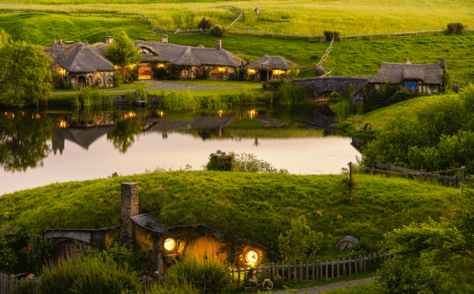
We walk through the village with its stores open, their wares displayed proudly on tables along the path, cafes with outside seating under small trees. Everyone smiles and says hello as we pass.

On the other side of the town we come to a small cottage and pass through its gate to the front door. She opens the door and walks in still holding my hand. As I cross the threshold she says, “Welcome home”.

My eyes adjust to the change of light and the rooms I am able to see feel familiar but new to me. She slowly closes the door behind us and I am frightened.  Will this end this dream for me to awake in that lonely house or become the beginning of a new reality?

New Years trip to Washington – Part 4

The next few days were spent visiting with the family and friends I do not get to see that often. My son had made a plan and got together a few friends to go on a little adventure on New Years morning out to Tillamook State Forest about 40 miles west of Portland, OR.

This 364,000-acre (1,470 sq kilometer) forest is managed by the Oregon Department of Forestry and includes areas for campgrounds, hiking and backpacking trails, fishing, swimming, timber operations and interpretative center. There are trails for horses and pack animals, mountain bikes and motorized vehicles. This temperate rainforest averages more than100 inches (2,500mm) of rain a year and is considered one of the wettest areas of the United States.

New Years Eve we were the old folks and went to bed early as we were meeting everyone out there at 8:30 the next morning, so an early start from home was mandatory. Up at 5AM I showered (to wakeup) made a good breakfast and got my snack items and lunch for the day ready.

Arriving a little early we got a meeting spot at Browns Camp and were amazed at the number of people with the same idea. The staging area was filling up fast. Finally the last straggler pulled in, we organized everyone to communications, the general route and off we went with my son leading the way.


Heading up Firebreak Trail from the staging area and into the State Forest was great, the further back in we went the less people we encountered.

Finishing this short trail we head along Power-line Trail and we swing back onto forest service roads at University Falls to make our somewhat meandering way south to……


…..the fun Cedar Tree Trail where we drive under a fallen cedar tree, you don’t get to do that to often.

Back onto Forest service roads we meander north back to Browns Camp for a rest stop before our drive back home.


What a great way to start off the new year meeting new people, traveling this adventure with 10 other family filled vehicles and being out in the forest on a brisk but beautiful day. The 18 mile tail run was so much fun. Getting back home in the late afternoon we had dinner and relaxed for the night discussing what other adventures we should have in the next few days.

Sharing/Giving Away 2016-1-13

Sea Shells

Sea Shells

“I am a big man. See all the shells? They are very valuable in our culture. I could have trunks of them……but then I wouldn’t be a big man. A big man gives away what he has and shares with others. ”                                 –New Guinea Elder

“From Native Wisdom for White Minds” by Anne Wilson Schaef

There are many sayings in this book that have relevance to our daily lives, it is written to provide one daily reflection each day of the year.

I have met many people in our travels that have shown the importance of sharing, wether it is material, information, their time or spirituality it has shown special qualities of these individuals and I cherish them all.