I had just an evening and a few hours the next morning to explore the Alabama Hills. I got in after dark and it was very windy and cold Halloween night so I didn’t want to spend too much time outside. I shall return with more time to explore the Movie Road and Movie Flats to find the locations of the arches and television / movie shooting locations. The Museum of Western Film History in Lone Pine will provide a history and has information and self-guided tours of the area.
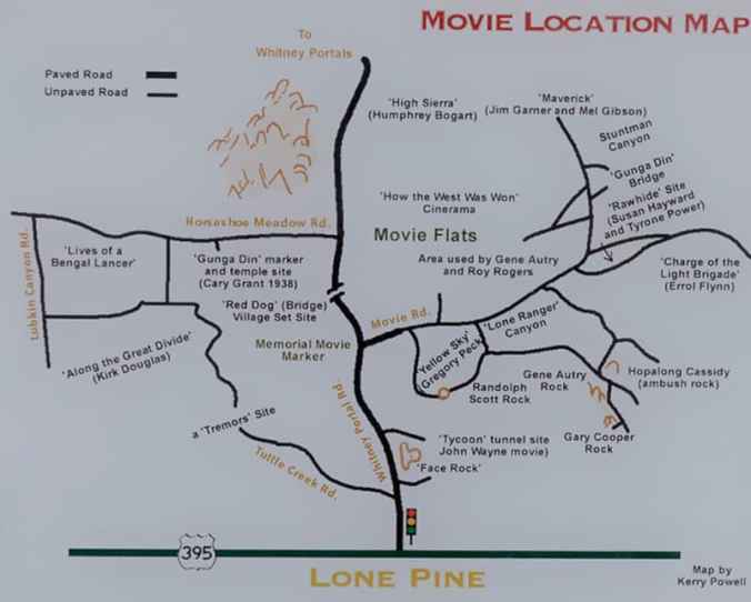
Map of several of the Alabama Hills movie sites
These hills, arches and rock formations on the eastern slope of the Sierra Nevada are in the shadow of Mount Whitney just west of the California town of Lone Pine. Located right off the road to Whitney Portal, the starting point for climbing the 11th highest peak in the United States and the tallest in California, this BLM land is open for exploring, hiking, astronomy, camping and exploring. The formations are part of the same geological formation although geographically separate from the Sierra Nevada Mountains just adjacent to the east
Morning in the desert of Alabama Hills
Morning in the desert of Alabama Hills
Morning in the desert of Alabama Hills
Mines in the area were named after the Confederate Civil War ship the CSS Alabama by sympathetic confederate miners of the time and then it became the name of the entire area. When the Alabama was finally sunk by the USS Kearsarge in 1864 the mining district, a mountain pass and peak and a town were named Kearsarge by sympathetic union miners.
Used by television and movie productions for filming, especially Westerns. Since the 1920’s this rugged environment has been shown in approximately 150 movies and a dozen television shows. A few of the early television shows have been Tom Mix, Hopalong Cassidy, The Gene Audrey Show, The Lone Ranger, and Bonanza. While Gunga Din, The Walking Hills, Yellow Sky, Springfield Rifle, The Violent Men, Bad Day at Black Rock and How the West was Won are some of the Movie Classics. Current Films have included Gladiator, Django Unchained, Iron Man, Man of Steel, Firefly and Tremors.
Nighttime is just as impressive as the landscape during the day as the Alabama Hills is a Bortle Class 2 “average dark sky” site. On a clear moonless night many star formations and the Milky Way appear brightly in the night sky.
I left Vancouver for southern California and my first overnight stop was Lassen Volcanic National Park in northern California. As the name implies it’s major features are volcanic in origin. Being the southern most volcano of the Cascade Range the prominent features of the park are the largest plug volcano in the world, Lassen Peak and it’s sulfur – thermal hot springs.
Originally two separate National Monuments dedicated in 1907 by Theodore Roosevelt, Cinder Cone and Lassen Peak National Monuments were declared Lassen Volcanic National Park in 1916.
I arrived late in the afternoon after an 8 1/2 hour drive and set up camp at Manzanita Lake Campground located in the northern section of the park. Then I proceeded to walk the loop trail around Manzanita Lake, ate dinner and enjoyed a nice campfire before retiring to my tent to read and fall asleep.
Campsite at Manzanita Lake
Manzanita Lake
Manzanita Lake
Manzanita Lake
Evening at the campsite
Accessible by five vehicle entrances the majority of visitors enter either from the north or south along State Route 89, named the Volcanic Legacy Scenic Byway or Lassen Volcanic National Park Highway, off State route 44 in the north and 89 from the south. Three unpaved roads enter the park but do not connect with the main road through the park, Highway 89.
The north-south 29-mile (46.6k) road, Highway 89, was constructed between 1925 and 1931. The road summit is the highest in the Cascades topping at 8,512 feet (2,594 m). This road is closed in the winter months due to snow, which can reach 40 feet (12.2m) deep.
Early morning along the Lassen Volcanic National Park Highway
I got up early, had a quick breakfast and packed up to head south along Route 89 to visit the sites of the park. It was very interesting stopping at the many informative signs along the road to read the history of the park.
The last minor to major eruption started in 1914 and lasted until 1921 creating a new crater on Lassen Peak. Releasing ash and lava it fortunately did not kill anyone. This eruption covered many miles of forestlands with landslides and the new growth forest today stands many feet above the old forest floor. These landslides also created Manzanita Lake as it damned Manzanita Creek.
The first blast was on May 19, 1915 and was said to be a night to remember with it’s steam explosion and subsequent mudflows. Had it not been for Elmer Sorahan many people might have died but he ran 3 miles (4.8k) to warn others after escaping the explosion.
Hot Rock today
Three days later on May 22, 1915 another explosion on Lassen Peak threw ash, pumice, rock and gas into the air that was more devastating to the area than the first. The pressure in the mountain built up like a lid on a boiling pot of water and finally blew. You can now explore this area on a ½ mile (0.8k) loop trail or take the strenuous 2,000 foot (609.6m) 5 mile (8k) round trip hike to the top of 10,457 foot (3,187m) Lassen Peak. Many other hiking opportunities exist in the park along with backpacking, auto-touring, bird watching, camping skiing, skiing, snow play, and snowshoeing.
There are 5 hydrothermal areas to explore within the park. Sulphur Works, Bumpass Hell, Devils Kitchen, Boiling Springs Lake and Thermal Geyser. I am limiting myself to 2 for this trip.
My first hydrothermal area would have been the hike out to Bumpass Hell Hydrothermal Area, a moderate 3 mile (4.8k) round trip hike. This is the largest hydrothermal area of the park with temperatures of up to 322 degrees F (161 degrees C). I had done this hike with my kids back in the early 1990’s although I found the trail closed this season for maintenance of the trail and boardwalk through the 2018 season.
My next stop was Sulphur Works, a formation of mudpots, steam vents and boiling springs located right off the main road. This hydrothermal area in near the center of a massive composite volcano that collapsed many thousands of years ago. Mount Tehama or Brokeoff Mountain was estimated to be 1,000 feet (304m) higher than Lassen Peak. Active 400,000 to 600,000 years ago it is estimated to be nearly 11 miles (17.7k) across and had towered to 11,500 feet (3,505k).
Sulphur Works
Mudpot at Sulphur Works
Brokeoff Mountain from Suphur Works parking lot
My final stop was the Kohm Yah-mah-nee Visitor Center at the south entry of the park to visit the small museum learning the history of the park, peoples and area and had a nice talk with the Rangers.
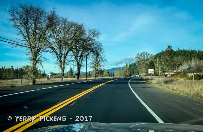
Now for the long 8 hour drive down the east side of the Sierra Nevada Mountains along State highway 395 to the BLM area of Alabama Hills outside of Lone Pine, CA.
Well I am heading back out to Bickel Camp, Burro Schmidt Tunnel and a ranger led hike into Nightmare Gulch in Red Rock Canyon State Park for a fundraiser to help offset expenses on the upkeep of Bickel Camp.
Bickel Camp is full of mining equipment on display at this historic 1930’s era mining camp. The camp is still there to be visited by the adventurist explorer. Luckily this has remained on the “Adopt-A-Cabin” program and there is a caretaker on site to help explain and protect the remaining historic artifacts. Donations to help preserve and maintain the site are appreciated. 2 of Walter Bickel’s granddaughters were there walking us around the camp and telling of the fun they had out here when they visited. They told us one story of Bickel finding a stranded motorist in the desert and helped him get unstuck, turned out it was Jimmy Durante. Another interesting fact was that both Bickel and Schmidt were in the service during WWII, living within sight of one another they had a strong friendship and even rigged up automobile headlights so they could send messages back and forth in Morris Code. And yes the light at Bickel Camp is still standing.
For a full history on this wonderful place to visit follow this LINK.
Bickel Camp
Bickel Camp
Listening to the tales of Bickel Camp
Bickel Camp Equipment
Bickel Camp Equipment
Bickel Camp Equipment
Bickel Camp Equipment
Bickel Camp Equipment, tractor radiator
Bickel Camp Equipment
Bickel Camp Equipment
Bickel Camp Equipment
Bickel Camp Equipment
Bickel Camp Equipment, nice old Datsun 1600
Bickel Camp Equipment
Bickel Camp Equipment, old refrigerator anyone
Bickel Camp Equipment, homemade table saw
Bickel Camp Equipment has been here a long time
Bickel Camp Equipment
After wandering around the camp and being entertained by first hand stories from the granddaughters we all head the few miles down the trial to Burro Schmidt’s Tunnel to explore the hand-drilled tunnel nearly a half-mile long that was dug with a single 4-pound jackhammer, and dynamite.
For additional information see my previous post LINKED HERE.
Walking through Burro Schmidt’s Tunnel
Exiting Burro Schmidt Tunnel on the south side
Next up it was to find our way back to asphalt and turn south into Red Rock Canyon State Parkand the hike into Nightmare Gulch. We all meet-up for a short lunch stop at a park rest area before heading out the dirt road to the trail head. Although we did not do the loop we drove as far as we could to the official trail head and took a 5-mile total out and back hike into the canyon. Led by 3 Bureau of Land Management rangers we were given lessons in history, geology and ecology of this area. It was a great hike and took most of the afternoon.
Trail to Nightmare Gulch
Nightmare Gulch
Trail to Nightmare Gulch
Nightmare Gulch
Ranger led hike at Nightmare Gulch
Ranger led hike at Nightmare Gulch
Nightmare Gulch
Nightmare Gulch
Nightmare Gulch
Nightmare Gulch
Nightmare Gulch
Nightmare Gulch
Nightmare Gulch
Nightmare Gulch
Nightmare Gulch
Nightmare Gulch
Nightmare Gulch
Nightmare Gulch Pano
Leaving the trail head at about 4:30PM I still had a 3 hour drive home. Arriving home at 7:50 PM I was exhausted as I got up at 3AM to get there and meet someone at the turnoff to the Camp. This adventure was wonderful as I met new adventurers and discovered this magnificent canyon that I will return to to follow the entire loop trail.
Getting up before dawn I left home in Orange County to head for my first nights stay in Eureka, CA. 682 miles and 11 driving hours from home. It was going to be a long day that took me up Interstate 5 to Interstate 580 through the east San Francisco Bay Area, up to Richmond and across the Richmond-San Rafael Bridge to link to Highway 101. This bridge is the northernmost east-west crossing of the bay. Opened in 1956 the tolls are only collected heading west.
Interstate 5 through the Central Valley of CA
RIchmond-San Rafeal Bridge
RIchmond-San Rafeal Bridge
RIchmond-San Rafeal Bridge
Connecting to Highway 101 I continue up this iconic road through the California Redwoods and my destination for the day Eureka, CA and a cozy room for the night.
Highway 101
I used Air BnB to locate this very comfy, quiet room with a separate entry and bath in a residential neighborhood in the south east of the city. Colorful Corner was all that it was advertised and the host Patricia was a marvelous person to meet. We talk via email before my arrival, she gave me suggestions for places to have dinner and to visit on my way north the next day. Along the way Patricia texted me that she might not be home when I arrived and gave me the access code to the room, Although when I did arrive, after 12 ½ hours of travel time, she was home and we had a delightful talk as I dropped my things in the room and headed out to dinner.
B&B
B&B
B&B
B&B
B&B
B&B
A port city on Humboldt Bay in Northern California, Eureka’s Old Town district and throughout the city features beautiful Victorian homes in all states of repair. The bay was overlooked by early European Explorers and not settled until 1849 when it was discovered by an overland expedition. The second largest bay in California was the jumping off point and base for the early gold miners of Northern California who did not want to take the long overland trip from Sacramento. Eureka got its name from the eager gold miners of the day, its Greek meaning “I have found it” is also the state motto of California. Timber, shipping, fishing, boating and a strong commercial district has shaped the largest coastal city between San Francisco, CA and Portland OR throughout it’s history and to this day.
The cool Mediterranean climate has an average high August temperature of 64.3 °F (17.9 °C) and an average December temperature of 47.8 °F (8.8 °C) With an average of 40.3 inches (1,024 millimeters) of rain per year falling on an average 119 days during the year. The city might also be covered in a blanket of fog for most of the year.
Climbing into bed, exhausted, I appreciated the warm, comfortable, quiet room and slept like a baby until the next morning.
It has been many years since I last visited the San Diego Zooin Balboa Park. This zoo of approximately 3,700 animals of roughly 650 species and subspecies is situated on 100 acres (40ha) and is one of the most well-regarded zoos in the USA. it was a product of the 1915 Panama-California Exposition using the wild animal enclosures that were abandoned when the exposition ended. Its permanent location was agreed upon in 1921 on land and with animals owned by the City of San Diego and managed by a conservatory. The zoo is a pioneer of cage-less exhibits that protect the animals and visitors by a moat system.
At the end of May I decided to head out to Joshua Tree National Park to visit the Old Dale Mining Districton BLM land that is located just outside the northeast portion of the park. Joshua Tree National Park is an environmental melting pot where 2 desert ecosystems meet, the Mojave Desert to the north and west and the Colorado Desert to the south and east. The Mojave Desert ecosystem consists of boulder stacks with pinyon pines, junipers and scrub oaks and the famous joshua tree. The Colorado Desert ecosystem in contrast consists of creosote, spidery ocotillo and jumping cholla cactus. Jumping cactus or teddy bear cactus got its name from the fact it tends to stick to anything within its range and is very painful to remove from the skin.
A few weeks ago my grandson and I visited the Orange Empire Railway Museum(LINK) when the annual Steampunk fair was being held. This non-profit museum opened in 1956 to preserve Southern California’s railway history that dates from the 1870’s. With over 200 historic railway locomotives, passenger cars, freight cars, streetcars, interurban electric cars, buildings, and other artifacts from Los Angeles and the West, the 90-acre site in Perris, California is open to the public every day except Thanksgiving and Christmas (check site for current opening days, times and special events).
On my way up to visit my son, his wife and my grandson I stopped for the night for a stroll among the redwood groves. I stayed at the Burlington Campground in the Humboldt Redwoods State Park of northern California just north of Meyers Flat. Situated along the Avenue of the Giants, a 31 mile long country road that passes through 51,222 acres of stunning redwood giants.
Paralleling Highway 101 it provides an outstanding display of these magnificent trees. This state park is just a small section of the 500-mile redwood belt, the largest remaining virgin stand of redwood trees in the world. It is a beautiful place to picnic, hike, camp, raft, bike or just experience the silence in the groves. There are plenty of tourist sites and attractions to visit and some pretty good B&B’s around, from what I have read.
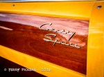
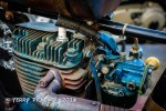
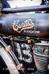
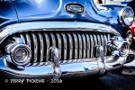
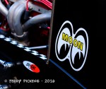
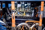
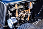
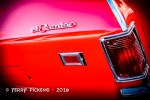
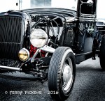
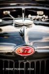
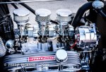
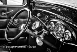
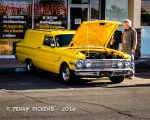
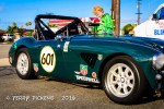
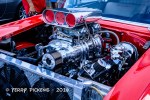
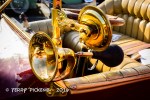
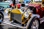
My son and his family came down from Vancouver for a family gathering celebrating the life of my lovely late wife Jodi. He has been excited to get down to visit family but also see a weekly car gather about ¾ of a mile from my house called Donut Derelicts put on by Adams Ave Donuts. This is an informal weekly gathering of cars and motorcycles held in Huntington Beach, California for about 30 years. We walk to the parking lot on the northeast corner of Magnolia Street and Adams Avenue to walk around the gathering that has no rules, no fee, no prizes, no formal competition, and no flyers that sometimes pulls in several hundred vehicles from all over the southland.
We had a great 2 hours wandering around photographing the cars. Here is a gallery of some of the cars of Donut Derelicts:


You must be logged in to post a comment.