Cape Disappointment State Park, WA

Named by Captain John Meares’ 1778 disappointing sailing to find the mouth of the Columbia River for trading. Being turned away by a severe storm, he named this place Cape Disappointment. While in complete contrast Lewis and Clark’ s Corps of Discovery cheered as they completed their journey with their first sight of the Pacific Ocean on a bluff on Cape Disappointment.

“Cape Disappointment Map 07-27-16”

Cape Disappointment State Park is far from being a disappointment. Steeped in Northwest history, it is a place to explore U.S. military and maritime installations, learn more of Lewis & Clark’s Corps of Discovery Expedition and their effects on native tribes of the area. Camp, fish, hike old-growth forests, roam around freshwater lakes, saltwater marshes and ocean tidelands. Marvel at the breathtaking views from the highlands above the sea and wander the beaches that are enjoyed by kite-fliers, beachcombers, sandcastle builders and those who just love to walk. Hike to 2 lighthouses that guided the mariners to the mouth of the river and kept them from becoming victims of the Grave Yard of the Pacific.

Lewis and Clark Interpretive Center

I began my day at the Lewis and Clark Interpretive Center and one of the Battery’s of Fort Canby that defended the entrance to the Columbia River from the mid 1900’s to the end of World War II. The Interpretive center is a museum providing a history lesson of The Corps of Discovery’s journey from settled America along the Mississippi River to the Pacific Ocean. Walk along the history path in its interactive exhibits that will entertain all ages. Sitting right above Battery Harvey Allen of Fort Canby to the inland side and overlooking the Pacific Ocean from its cliff side perch it is a wonderful place to start your visit to the park.

Off to the south from the ocean-viewing platform of the Interpretive Center you see Cape Disappointment Lighthouse. Start the hike to the lighthouse in the Interpretive Center’s parking lot. You’ll walk through dense forest glimpsing ocean and river views as you make your way to the oldest operating lighthouse in the Pacific Northwest. Built in 1856 to warn the ships of the treacherous currents and obstacles of the river bar at the mouth of the river.

Continuing on driving I thought I made a very wrong turn as I saw a sign for Waikiki Beach. It is a short ¼ mile (0.4 k) walk to the beach. It was still overcast when I visited although I suspect it would be a nice place for a picnic lunch and to watch the waters and vessels of the Columbia River float past.

Continuing my exploration of the park I stopped a short time later at the trailhead to Battery 247 that is perch on a hill in a strategic location overlooking both the Pacific Ocean and the Columbia River. Very deteriorated and overgrown it is an interesting structure to wander through. Although being small I recommend bringing some type of flashlight or headlamp to go deeper into the underground ammunition building. This is also the area where Lewis and Clarks Corps of Discovery first laid eyes on the Pacific Ocean.

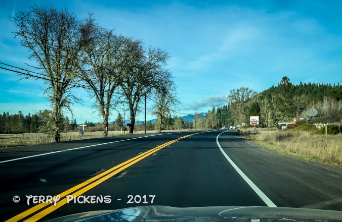
Following the road a little further leads me to the campground. I wish to see if I wanted to spend the night here. I found it to be a nice place right along the ocean and went back to the entry station to reserve a site for the night. I wanted a quiet spot to relax for the night so selected site #157. My site is not right along the beach, although a few are, but only 200 yards (183 m) away. In this group of 9 campsites there were only 2 other sites being occupied.


Having settled my accommodations for the night I drove up to North Head Lighthouse to walk the pathway to the base of the lighthouse. This second lighthouse was built as the Cape Disappointment Lighthouse left a section of coast unprotected from a mariner’s point of view. Built 190 feet (60 m) above sea level in 1898 this 65’ (19.8 m) tall lighthouse is still functioning and maintained by the U.S. Coast Guard. This is located on one of the windiest places along the west coast with recorded winds of up to 120 MPH (321.9 km/h).

Finished for the day I returned to set up camp and have a snack before I took a walk along the beach outside my temporary front door. The beach was an easy walk although exploring higher up the high tide line finds many logs that have been deposited along the beach during the severe storms coming in off the Pacific. Many small windbreak structures have been built by visitors add to the cozy feel of the beach.

Deciding to go back and grab my camera tripod, I return to the beach to watch the sun setting in the west. After a wonderful rest and watching a beautiful sunset I proceed back to my camp, fix a small dinner and climb into the tent early to do a little reading then to fall asleep listening to the waves crashing into the shore.

I will return here again to continue exploration of the trails in the area. The 1.5 mile (2.4 k) Coastal Forest Loop trail, Bell’s View Trail, the 1.5 mile (2.4 k) long North Head Trail and the south portion of the coastal Discovery Trail will be on the short list of walks.

I continue my journey in the morning crossing back into Oregon to visit Fort Stevens then head a little further south to see another fantastic beach.

January 27,2018 Bickel Camp Fundraiser


IMG_3425

Good Morning, 6:30 AM 28F degrees

Well I am heading back out to Bickel Camp, Burro Schmidt Tunnel and a ranger led hike into Nightmare Gulch in Red Rock Canyon State Park for a fundraiser to help offset expenses on the upkeep of Bickel Camp.

Bickel Camp is full of mining equipment on display at this historic 1930’s era mining camp. The camp is still there to be visited by the adventurist explorer. Luckily this has remained on the “Adopt-A-Cabin” program and there is a caretaker on site to help explain and protect the remaining historic artifacts. Donations to help preserve and maintain the site are appreciated. 2 of Walter Bickel’s granddaughters were there walking us around the camp and telling of the fun they had out here when they visited. They told us one story of Bickel finding a stranded motorist in the desert and helped him get unstuck, turned out it was Jimmy Durante. Another interesting fact was that both Bickel and Schmidt were in the service during WWII, living within sight of one another they had a strong friendship and even rigged up automobile headlights so they could send messages back and forth in Morris Code. And yes the light at Bickel Camp is still standing.

For a full history on this wonderful place to visit follow this LINK.


After wandering around the camp and being entertained by first hand stories from the granddaughters we all head the few miles down the trial to Burro Schmidt’s Tunnel to explore the hand-drilled tunnel nearly a half-mile long that was dug with a single 4-pound jackhammer, and dynamite.

For additional information see my previous post LINKED HERE.


Next up it was to find our way back to asphalt and turn south into Red Rock Canyon State Park and the hike into Nightmare Gulch. We all meet-up for a short lunch stop at a park rest area before heading out the dirt road to the trail head. Although we did not do the loop we drove as far as we could to the official trail head and took a 5-mile total out and back hike into the canyon. Led by 3 Bureau of Land Management rangers we were given lessons in history, geology and ecology of this area. It was a great hike and took most of the afternoon.


Leaving the trail head at about 4:30PM I still had a 3 hour drive home. Arriving home at 7:50 PM I was exhausted as I got up at 3AM to get there and meet someone at the turnoff to the Camp. This adventure was wonderful as I met new adventurers and discovered this magnificent canyon that I will return to to follow the entire loop trail.

New Years trip to Washington – Part 6

Well we plan another easy day as it’s getting late in the trip and I think we are all tired from all the visiting and traveling that has been done. Today it was decided to go to a nature reserve for a short drive and walk, as the weather is finally getting rainy. Imagine that, rainy weather in the Pacific Northwest during winter.

This 5,150-acre (2,084 ha) area of marshes, grasslands and woodlands, named the Ridgefield National Wildlife Reserve is just north of Vancouver, WA and is one of 4 reserves located along the Columbia River in the greater Vancouver area. Established in 1965 to protect waterfowl, it was established with the 3 other refuges in the Willamette Valley for wintering birds migrating and nesting from Alaska.

The area includes a 2-mile (3.2 k) self-guided walking trail that’s objective is to showcase the Columbia River Watershed, the 4.2-mile (6.75 k) auto tour route and a seasonal 1.2-mile (1.9 k) hiking trail.

Managed by the U.S. Fish and Wildlife Service it protects sandhill cranes, various shorebirds, and a large variety of songbirds, mallards, great blue herons, and red-tailed hawks. Mammals calling the reserve home include deer, coyote, raccoon, skunk, beaver, river otter, and brush rabbits.

The refuge consists of five sections, each unique in habitat supporting the wildlife that reside there. Two of these sections are open to public visitation and enjoyment, while the remaining three are kept as sanctuary for wildlife to rest, nest and escape human disturbance. This maintains an important balance for those species less tolerant to human presence to thrive in an increasingly urban area.  The visitors then get the chance to view and experience wildlife and habitat, receiving the many benefits of being out in nature.

The Columbia River has long sustained human population and dates back long before Euro-American arrived. There have been large Native American settlements found on the reserve. The refuge also preserves the most intact archaeological site on the lower Columbia River with evidence of at least 2,300 years of continuous human occupation. That history and culture is interpreted through the Cathlapotle Plankhouse built in 2005 and open to visitors on the weekends in the spring and summer. The plankhouse was built to represent the buildings Lewis and Clark might have found here at their Wapato Portage village.

Since we are visiting in January we are not to leave the car due to the large flocks of geese and ducks nesting in the area between October 1st and April 30th. The cars become your movable animal blind as the birds are accustomed to the vehicles presence. There is an observation blind halfway along the route you can park and take the short hike out to it.

There are 14 interpretive markers and signs along the way along the one-way road. It was a fun drive as we were one of the few vehicles in the reserve on this weekday morning. We saw many birds, mammals and 2 deer along our route. When we left the car to hike to the blind my grandson had an old cell phone that he uses to take photos and he was just shooting away at all the details on the forest floor trying be like his Dad, it was so cute.

It has been a tiring week of visiting family, meeting new people and seeing new sights so we leave at lunchtime to head home for a late lunch as I need to pack and rest for my drive home.

New Years trip to Washington – Part 5

We take a day to rest, clean and organize our things from the adventure at Tillamook State Forest then decide to head north from Vancouver, WA for a day trip to Battleground Lake to enjoy the nature surrounding it. Being winter it is raining off-and-on today, so we go down to the lakeshore so my grandson can have some fun trying to fill the lake with rocks he finds on the shoreline. This is something he really enjoys, he has thrown rocks at Mt Adams, into the Snake River in Grand Teton National Park and now here. Kids are so funny how they entertain themselves. We discussed hiking the trail that goes around the lake but decided that with the rain it would just be a slick mess.


After our short stay at the lake we head to The Cedar Creek Grist Mill just outside Etna south of the Lewis River along scenic Cedar Creek. A gristmill grinds grain into flour using nature’s forces, usually water being run by a water wheel. The first water-powered mill was reported around 71 BC in Asia Minor. Grain mills in England were counted in the 1086 Domesday Survey In England, which stated there were 5,624, or about one for every 300 inhabitants that year, peaking to 17,000 by 1300.

Cedar Creek Grist Mill is a working museum allowing visitors inside to observe the workings of the mill built in 1876. Samples are given to visitors after the tour of the facility. This is a totally nature driven mill using the water flowing through a plumb to a Leffel turbine installed with its flume (water canal) around 1888. Pulleys, and belts turn the milling stone producing flour, corn meal and sometimes apple cider.


Resting on a steep and rocky slope in the narrow gorge of Cedar Creek, it is the only gristmill in Washington that still maintains its original structure, mills with stones, and is water powered, this is also the oldest building in Washington State still producing its original product.


The last owner died in the late 1950’s and the property was bought by The State Fisheries Department in 1961 that removed the old dam and built a fish ladder. The Fort Vancouver Historical Society leased the mill in 1961 and had it registered as a National Historical Place.

Time, weather and vandals took its toll by 1980. “The Friends of the Cedar Creek Grist Mill”, a non-profit corporation, was formed to save the old mill. Using period tools consisting of axes and adzes they replaced the damaged posts and beams. Due to a dam removal in 1961 they had to now get water into the mill, extending the flume 650 feet where the water from the creek could flow into the intake without the dam.

Next to the mill is a covered bridge across Cedar Creek. There is no history on the first bridge although it was completely replaced by a truss bridge in 1935. The 1935 bridge could not support heavy loads, so in 1994 a new covered bridge spanning Cedar Creek was built.


Sadly it was closed on this weekday right after the holiday but peeking in the windows demands a return visit when it is open.

New Years trip to Washington – Part 3

I wake up starving and head down to breakfast provided by the Quality Inn in their small dining area. Starting off with cereal, I consume that and there is still a large hole in my belly so back to the buffet line I go for a second helping of something more substantial. AH HA, I spot bacon, sausage, a waffle maker, biscuit, muffins, bagels, English muffins, white gravy, donuts and more. I decide biscuits with gravy, a couple of sausages, a bagel and some orange juice will fill the hole very nicely. Finishing all this my stomach is finally quite happy.

Back to the room to clean up, pack and get on the road for the day, it is still dark outside at 7AM as I pull out of the parking lot.

Heading south for 14 miles (22.5 k) I follow a small dead-end road to Cape Arago State Park looking for the Cape Arago Lighthouse. I reach a turn around at the end of the road and get out to investigate this picnic/hiking area still searching for the lighthouse. The sun is just coming up and it is cold and windy, I almost loose my hat in the gusts of wind. This would be a lovely place to visit in good weather. Continuing back along the same route I notice a sign for a botanical garden that would make another interesting stop but still being too early it is closed. Further on I spot the lighthouse. Wondering how I get to it I find a road that is signed “Lighthouse Road, NO ACCESS TO LIGHTHOUSE”. Disappointed I am glad I stopped to get the photos I did from Sunset Bay pullout when I saw it in the distance.


The first lighthouse was built and illuminated in 1866 due to the amount of shipping that was coming and going in Coos Bay. This tower was only 25-foot (7.6 m) high with an open base. Connected to the keeper’s residence via a 1,300-foot (400 m) wooden walkway this tower was soon in need of repair due to its western exposure on the small island. In 1890 a second wooden tower, located higher on the island, stood 100 feet (30 m) tall providing better illumination. Erosion threatened this light and in 1934, the third light was built made from concrete to better withstand the inclement weather of the area. Decommissioned on January 1, 2006 the third light remains, all other accessory buildings have been demolished.


Continuing back to Highway 101 I head north for my next stop at Umpqua Lighthouse, 34 miles (54.7 k) north. A Coast Guard survey during the summer of 1849 determined the best locations for lighthouses along the coast. The mouth of the Umpqua River was selected as one of only six sites in the Oregon Territory, which included the modern day states of Oregon and Washington. In the fall of 1856, the officer in charge of lighthouses approved the erection of the lighthouse at Umpqua. In Oregon Territory, local tribes used the Umpqua River as prime hunting and fishing grounds and did not want the lighthouse built. But rather than attacking the Lighthouse the local tribes sabotaged the construction by stealing critical tools and supplies. Lit in October 1857 this was the first light along the Oregon Coast. The structure of the original lighthouse was compromised due to a sandy soil and river flooding not considered by the builders. The light was being removed in 1861 when the workers ran for their lives and watched the tower come crashing down just after they removed it’s light.


The lighthouse was replaced with a buoy and a decision that a new light at Cape Arago, twenty-five miles to the south would better serve seafarers. Eventually in 1888 it was petitioned that a new lighthouse be built at Umpqua so that a ship at sea would pass from one light to the next with out loosing sight of a light on land. Building the lighthouse further inland on a headland above the mouth of the river this is the farthest distance from a river or ocean of all the lighthouses along the Oregon Coast.

The new lighthouse keepers were housed in a duplex home, for the two assistants, a barn, cisterns, and two oil houses that were completed on January 1893. All that remained to be done now was to install the lens in the tower and the light was finally established on December 31, 1894. This new lighthouse stood 165 feet (50.3 m) above sea level and was constructed of brick with a plaster overlay. Decommissioned April 28, 2009 it was  “no longer a critical component for safe navigation”.

3 to WA-6

Highway 101 in Oregon

I head north 40 miles (64.4 k) on Highway 101 to Heceta Head Lighthouse in Devils Elbow State Park.

Just a few headlands over from the Sea Lion Caves lies one of the most photographed lighthouses in Oregon, the Heceta Head Lighthouse. Surrounded by a state campground and park, the lighthouse can be seen from Highway 101, or visited if you are willing to take a short uphill hike.


Parking at the Heceta Head Lighthouse State Park there is a lot for day-trippers to experience the surrounding area. The Scenic Viewpoint on 101 is a great way to see a number of different attractions although parking below the historic Cape Creek Bridge will let you walk out onto the beach, bird watch the birds on the large rocks in the small bay, hikes or visit the lighthouse and caretakers cottage.

3 to WA-12

Walk to Heceta Head Lighthouse

Perched 150 feet (45.7 m) above the sea the Lighthouse is one of the most-visited lighthouses in the United States, with thousands of visitors each year enjoying its history, romantic aura, and a beautiful setting.


In 1888 the Lighthouse Board recommended that a first-order lighthouses be constructed here at Heceta Head and at Umpqua River. Looking at the forested site today it is hard to imagine that there was very little vegetation when the lighthouse was constructed. A forest fire swept through the area a few years earlier, wiping everything out. Construction began in 1892 with the contractors completing the dwellings, barn, and oil houses in January 1893. The 56 foot (17 m) tall masonry tower stands fifty-six feet tall has it’s light 205 feet (62.5 m) above sea level. This is the most powerful light on the Oregon coast and can be seen 21 miles (33.7 k) out to sea. With three keepers and their families at Heceta Head, a small, one-room schoolhouse was built at the station to educate the children.


Life became a little more modern and less isolated in the 1930s as the Oregon Coast Highway was being built. In 1934 a power plant/garage was built to electrify the station eliminating the oil vapor lamp. Meanwhile the keeper’s dwellings received lights and an electric washing machine.

Early years Heceta Head Lighthouse

Early years Heceta Head Lighthouse

The station was originally equipped with a separate dwelling for the head keeper and a duplex for the two assistants. The addition of electricity reduced the keeper’s workload and in the end 1930s the position of second assistant keeper was eliminated. Thus the remaining two keepers occupied the duplex, and the single dwelling was removed in 1940.

75 Coastguardsmen were stationed at Heceta Head during World War II as part of a coastal patrol. The commanders lived in half of the duplex, while the enlisted men were housed in barracks erected on the site of the former keeper’s dwelling, they patrolled the coast with roughly 12 dogs 24 hours a day.

After atomization in 1963, the remaining duplex cottage was leased to Lane Community College for extra class space and since 1995 the cottage has served as a Bed and Breakfast. Heceta Head Light and Keepers Quarters were placed on the National Register of Historic Places in 1978.

It was 1:30 PM as I left the lighthouse and still needed to drive 191 miles (307.4 k) to my son’s house in Vancouver, WA. This dive took a little more time due to the Friday evening New Years Weekend traffic in the Portland Metro Area. Arriving at 5:30 PM we all went out for pizza and I fell into bed by 9:30 PM, tired after a very long tiring day.

New Years trip to Washington – Part 2

Up at 7AM in the dark, I showered, packed and departed to visit some painted ladies of the town. No not that kind, but the beautiful Victorian Houses located throughout the city of Eureka. My Air BnB host told me of Hillsdale Street and Carson Mansion as places to see fine examples of this Victorian, Queen Anne style of architecture.

These wonderful homes are located throughout the city in various stages of maintenance that go from restored to dilapidated conditions, along Hillsdale Street they are well maintained and are a great display of this style of architecture. Visiting Hillsdale Street lined with these homes brought back such a noustalgic past life that would have transported me back in time if it weren’t for all the modern cars parked out front.


Next stop was to have a breakfast consisting of 2 blueberry pancakes, 2 eggs, 2 pieces of bacon, hash browns and a large glass of orange juice to fuel my day of sightseeing along the California and Oregon Coast, yes I was hungry and finished it all. I planned to visit several scenic overlooks and lighthouses along the way to my next stop just north of Coos Bay, OR only 218 miles (350.8k) and 4 ½ hours of drive time north.

My first stop was still in Eureka, just down the street from breakfast, the Carson Mansion. Placed on the Historic American Building Survey in 1964 it is one of the most photographed Victorian homes in California. Completed in 1884 it has been a private club since the 1950’s.


My next stops, lighthouses in Trinidad, CA and Crescent City, CA were also recommended by Patricia, my B&B host.

Prior to satellite and electronic navigation sailors relied on dead reckoning, compass and visual sittings to sail the waters of the oceans, during the darkness of night they relied on the stars and visual sightings. Many ships were lost due to running aground due to heavy weather along dangerous coastlines.

Fires built on hilltops once defined port access and placing that fire on a tall platform increased its visibility out to sea. Later lighthouses were located along coastlines to help define the coastal shoreline and locate dangerous areas that could sink a ship. In heavy fog, that is quite common along coastlines, so a light and foghorns (bells in olden times) warned mariners of hazards.


Trinidad Lighthouse is only 20 miles from Eureka located on Trinidad Head a small section of land jutting south out from the coast defining the harbor entrance. Built in 1871 the small 20-foot (6.1m) tall tower sits on a promontory 176 feet (53.6m) above the sea. Originally consisting of the light tower, a single residence, and small barn; a fog bell house was constructed in 1898 with a 4,000-pound (1,800 kg) bell that was operated by weights. The Trinidad Civic Club erected a facsimile of the tower in 1949 at a park overlooking the harbor and installed the original lighthouse lens in its structure and the 4,000-pound bell displayed alongside the tower. This Memorial is now under protest by local Native Americans stating it has been built on an ancient burial ground.


62 miles (99.7k) north of Trinidad is the Lighthouse in Crescent City on Battery Point. This lighthouse built in 1855 is on a tiny point of land that is only accessible during low tide. Built in a Cape Cod style of architecture this lighthouse survived the March 27, 1964 Alaska earthquake tsunami that hit the city and killed 11 people.


Heading into Oregon I stop 35 miles (56.3k) north at Whaleshead Beach to walk along the sand and enjoy the coastal scene.

2 to Coos Bay-18

Whalesehead Beach, OR

Another 58 miles (93.2k) later I stopped at Cape Blanco Lighthouse at 3 PM. A lighthouse sitting on 200-foot (61m) high cliffs jutting 1-½ miles (2.4k) out into the Pacific Ocean, this forested head of land had to be cleared of the spruce forest so the light could be visible from sea. Getting out of the car was a struggle; the wind was blowing so hard I could barely stand up. Walking the ¾ mile or so path to the lighthouse along a ridge-line didn’t interest me today so I leaned against a pole just to get a steady photo of the lighthouse. I’ll return on a future trip to visit this one.


On the way in off Highway 101 I noticed a sign leading to the Hugh’s Historic House (Hughes Ranch) that is listed on the National Register of Historic Places, I decided to go in and see it, as I didn’t make the journey to the lighthouse. Situated behind a hill it was in the calm leeward side away form the strong ocean winds. Built in 1898 for the dairy farm of Patrick and Jane Hughes this Victorian style two-story house was home to Mother, Father and 7 children. Local church groups decorated every room for the Christmas Holidays. The well appointed home with authentic furnishings was a joy to walk around and listen to the curators tell of life of the inhabitants.


Finishing the day’s 218-mile (350.8k) trek in North Bend, OR I stop for the night at a Quality Inn Hotel at 5 PM to rest for my final push to Vancouver, WA the next day. A nice clean quiet typical motel room awaited me that evening for another great nights rest.

New Years trip to Washington – Part 1

Getting up before dawn I left home in Orange County to head for my first nights stay in Eureka, CA. 682 miles and 11 driving hours from home. It was going to be a long day that took me up Interstate 5 to Interstate 580 through the east San Francisco Bay Area, up to Richmond and across the Richmond-San Rafael Bridge to link to Highway 101. This bridge is the northernmost east-west crossing of the bay. Opened in 1956 the tolls are only collected heading west.


Connecting to Highway 101 I continue up this iconic road through the California Redwoods and my destination for the day Eureka, CA and a cozy room for the night.

1 to Eureka-5

Highway 101

I used Air BnB to locate this very comfy, quiet room with a separate entry and bath in a residential neighborhood in the south east of the city. Colorful Corner was all that it was advertised and the host Patricia was a marvelous person to meet. We talk via email before my arrival, she gave me suggestions for places to have dinner and to visit on my way north the next day. Along the way Patricia texted me that she might not be home when I arrived and gave me the access code to the room, Although when I did arrive, after 12 ½ hours of travel time, she was home and we had a delightful talk as I dropped my things in the room and headed out to dinner.


A port city on Humboldt Bay in Northern California, Eureka’s Old Town district and throughout the city features beautiful Victorian homes in all states of repair. The bay was overlooked by early European Explorers and not settled until 1849 when it was discovered by an overland expedition. The second largest bay in California was the jumping off point and base for the early gold miners of Northern California who did not want to take the long overland trip from Sacramento. Eureka got its name from the eager gold miners of the day, its Greek meaning “I have found it” is also the state motto of California. Timber, shipping, fishing, boating and a strong commercial district has shaped the largest coastal city between San Francisco, CA and Portland OR throughout it’s history and to this day.

The cool Mediterranean climate has an average high August temperature of 64.3 °F (17.9 °C) and an average December temperature of 47.8 °F (8.8 °C) With an average of 40.3 inches (1,024 millimeters) of rain per year falling on an average 119 days during the year. The city might also be covered in a blanket of fog for most of the year.

Climbing into bed, exhausted, I appreciated the warm, comfortable, quiet room and slept like a baby until the next morning.