January 27,2018 Bickel Camp Fundraiser


IMG_3425

Good Morning, 6:30 AM 28F degrees

Well I am heading back out to Bickel Camp, Burro Schmidt Tunnel and a ranger led hike into Nightmare Gulch in Red Rock Canyon State Park for a fundraiser to help offset expenses on the upkeep of Bickel Camp.

Bickel Camp is full of mining equipment on display at this historic 1930’s era mining camp. The camp is still there to be visited by the adventurist explorer. Luckily this has remained on the “Adopt-A-Cabin” program and there is a caretaker on site to help explain and protect the remaining historic artifacts. Donations to help preserve and maintain the site are appreciated. 2 of Walter Bickel’s granddaughters were there walking us around the camp and telling of the fun they had out here when they visited. They told us one story of Bickel finding a stranded motorist in the desert and helped him get unstuck, turned out it was Jimmy Durante. Another interesting fact was that both Bickel and Schmidt were in the service during WWII, living within sight of one another they had a strong friendship and even rigged up automobile headlights so they could send messages back and forth in Morris Code. And yes the light at Bickel Camp is still standing.

For a full history on this wonderful place to visit follow this LINK.


After wandering around the camp and being entertained by first hand stories from the granddaughters we all head the few miles down the trial to Burro Schmidt’s Tunnel to explore the hand-drilled tunnel nearly a half-mile long that was dug with a single 4-pound jackhammer, and dynamite.

For additional information see my previous post LINKED HERE.


Next up it was to find our way back to asphalt and turn south into Red Rock Canyon State Park and the hike into Nightmare Gulch. We all meet-up for a short lunch stop at a park rest area before heading out the dirt road to the trail head. Although we did not do the loop we drove as far as we could to the official trail head and took a 5-mile total out and back hike into the canyon. Led by 3 Bureau of Land Management rangers we were given lessons in history, geology and ecology of this area. It was a great hike and took most of the afternoon.


Leaving the trail head at about 4:30PM I still had a 3 hour drive home. Arriving home at 7:50 PM I was exhausted as I got up at 3AM to get there and meet someone at the turnoff to the Camp. This adventure was wonderful as I met new adventurers and discovered this magnificent canyon that I will return to to follow the entire loop trail.

New Years trip to Washington – Part 6

Well we plan another easy day as it’s getting late in the trip and I think we are all tired from all the visiting and traveling that has been done. Today it was decided to go to a nature reserve for a short drive and walk, as the weather is finally getting rainy. Imagine that, rainy weather in the Pacific Northwest during winter.

This 5,150-acre (2,084 ha) area of marshes, grasslands and woodlands, named the Ridgefield National Wildlife Reserve is just north of Vancouver, WA and is one of 4 reserves located along the Columbia River in the greater Vancouver area. Established in 1965 to protect waterfowl, it was established with the 3 other refuges in the Willamette Valley for wintering birds migrating and nesting from Alaska.

The area includes a 2-mile (3.2 k) self-guided walking trail that’s objective is to showcase the Columbia River Watershed, the 4.2-mile (6.75 k) auto tour route and a seasonal 1.2-mile (1.9 k) hiking trail.

Managed by the U.S. Fish and Wildlife Service it protects sandhill cranes, various shorebirds, and a large variety of songbirds, mallards, great blue herons, and red-tailed hawks. Mammals calling the reserve home include deer, coyote, raccoon, skunk, beaver, river otter, and brush rabbits.

The refuge consists of five sections, each unique in habitat supporting the wildlife that reside there. Two of these sections are open to public visitation and enjoyment, while the remaining three are kept as sanctuary for wildlife to rest, nest and escape human disturbance. This maintains an important balance for those species less tolerant to human presence to thrive in an increasingly urban area.  The visitors then get the chance to view and experience wildlife and habitat, receiving the many benefits of being out in nature.

The Columbia River has long sustained human population and dates back long before Euro-American arrived. There have been large Native American settlements found on the reserve. The refuge also preserves the most intact archaeological site on the lower Columbia River with evidence of at least 2,300 years of continuous human occupation. That history and culture is interpreted through the Cathlapotle Plankhouse built in 2005 and open to visitors on the weekends in the spring and summer. The plankhouse was built to represent the buildings Lewis and Clark might have found here at their Wapato Portage village.

Since we are visiting in January we are not to leave the car due to the large flocks of geese and ducks nesting in the area between October 1st and April 30th. The cars become your movable animal blind as the birds are accustomed to the vehicles presence. There is an observation blind halfway along the route you can park and take the short hike out to it.

There are 14 interpretive markers and signs along the way along the one-way road. It was a fun drive as we were one of the few vehicles in the reserve on this weekday morning. We saw many birds, mammals and 2 deer along our route. When we left the car to hike to the blind my grandson had an old cell phone that he uses to take photos and he was just shooting away at all the details on the forest floor trying be like his Dad, it was so cute.

It has been a tiring week of visiting family, meeting new people and seeing new sights so we leave at lunchtime to head home for a late lunch as I need to pack and rest for my drive home.

New Years trip to Washington – Part 5

We take a day to rest, clean and organize our things from the adventure at Tillamook State Forest then decide to head north from Vancouver, WA for a day trip to Battleground Lake to enjoy the nature surrounding it. Being winter it is raining off-and-on today, so we go down to the lakeshore so my grandson can have some fun trying to fill the lake with rocks he finds on the shoreline. This is something he really enjoys, he has thrown rocks at Mt Adams, into the Snake River in Grand Teton National Park and now here. Kids are so funny how they entertain themselves. We discussed hiking the trail that goes around the lake but decided that with the rain it would just be a slick mess.


After our short stay at the lake we head to The Cedar Creek Grist Mill just outside Etna south of the Lewis River along scenic Cedar Creek. A gristmill grinds grain into flour using nature’s forces, usually water being run by a water wheel. The first water-powered mill was reported around 71 BC in Asia Minor. Grain mills in England were counted in the 1086 Domesday Survey In England, which stated there were 5,624, or about one for every 300 inhabitants that year, peaking to 17,000 by 1300.

Cedar Creek Grist Mill is a working museum allowing visitors inside to observe the workings of the mill built in 1876. Samples are given to visitors after the tour of the facility. This is a totally nature driven mill using the water flowing through a plumb to a Leffel turbine installed with its flume (water canal) around 1888. Pulleys, and belts turn the milling stone producing flour, corn meal and sometimes apple cider.


Resting on a steep and rocky slope in the narrow gorge of Cedar Creek, it is the only gristmill in Washington that still maintains its original structure, mills with stones, and is water powered, this is also the oldest building in Washington State still producing its original product.


The last owner died in the late 1950’s and the property was bought by The State Fisheries Department in 1961 that removed the old dam and built a fish ladder. The Fort Vancouver Historical Society leased the mill in 1961 and had it registered as a National Historical Place.

Time, weather and vandals took its toll by 1980. “The Friends of the Cedar Creek Grist Mill”, a non-profit corporation, was formed to save the old mill. Using period tools consisting of axes and adzes they replaced the damaged posts and beams. Due to a dam removal in 1961 they had to now get water into the mill, extending the flume 650 feet where the water from the creek could flow into the intake without the dam.

Next to the mill is a covered bridge across Cedar Creek. There is no history on the first bridge although it was completely replaced by a truss bridge in 1935. The 1935 bridge could not support heavy loads, so in 1994 a new covered bridge spanning Cedar Creek was built.


Sadly it was closed on this weekday right after the holiday but peeking in the windows demands a return visit when it is open.

New Years trip to Washington – Part 1

Getting up before dawn I left home in Orange County to head for my first nights stay in Eureka, CA. 682 miles and 11 driving hours from home. It was going to be a long day that took me up Interstate 5 to Interstate 580 through the east San Francisco Bay Area, up to Richmond and across the Richmond-San Rafael Bridge to link to Highway 101. This bridge is the northernmost east-west crossing of the bay. Opened in 1956 the tolls are only collected heading west.


Connecting to Highway 101 I continue up this iconic road through the California Redwoods and my destination for the day Eureka, CA and a cozy room for the night.

1 to Eureka-5

Highway 101

I used Air BnB to locate this very comfy, quiet room with a separate entry and bath in a residential neighborhood in the south east of the city. Colorful Corner was all that it was advertised and the host Patricia was a marvelous person to meet. We talk via email before my arrival, she gave me suggestions for places to have dinner and to visit on my way north the next day. Along the way Patricia texted me that she might not be home when I arrived and gave me the access code to the room, Although when I did arrive, after 12 ½ hours of travel time, she was home and we had a delightful talk as I dropped my things in the room and headed out to dinner.


A port city on Humboldt Bay in Northern California, Eureka’s Old Town district and throughout the city features beautiful Victorian homes in all states of repair. The bay was overlooked by early European Explorers and not settled until 1849 when it was discovered by an overland expedition. The second largest bay in California was the jumping off point and base for the early gold miners of Northern California who did not want to take the long overland trip from Sacramento. Eureka got its name from the eager gold miners of the day, its Greek meaning “I have found it” is also the state motto of California. Timber, shipping, fishing, boating and a strong commercial district has shaped the largest coastal city between San Francisco, CA and Portland OR throughout it’s history and to this day.

The cool Mediterranean climate has an average high August temperature of 64.3 °F (17.9 °C) and an average December temperature of 47.8 °F (8.8 °C) With an average of 40.3 inches (1,024 millimeters) of rain per year falling on an average 119 days during the year. The city might also be covered in a blanket of fog for most of the year.

Climbing into bed, exhausted, I appreciated the warm, comfortable, quiet room and slept like a baby until the next morning.

PLANNING PART 3 – Leaving Dawson for Skagway, AK and home

Lets go on an Adventure

ADVENTURE – An exciting, daring, bold, risky or very unusual experience or undertaking fraught with physical, financial or psychological risks.

Any ideas of what to visit in the areas I am traveling would be appreciated, not all sites are noted somewhere, secret spots abound. And if you share these secret spots with me to enjoy I will not post where they are but will relish in the beauty around me and be grateful you trust me with this shared this information.


Leaving Dawson I will ferry across the Yukon River, A major waterway in this area that is the 3rd longest river in the U.S. Heading west along Canadian Highway 9 to the border crossing into Alaska Crossing at a small border station I shall continue along Highway 5, The Taylor Highway, to pass Chicken, AK and finally end at the junction with Highway 2, The Alaskan Highway, to head southeast.

Dawson 2 Skagway 2017-11-17 at 1.52.06 PM

Crossing back into Canada I will continue then south along Canadian Highway 1 to visit Destruction Bay and Kluane National Park and Reserve.

kluane-PIC00016-edited

Kluane Lake from Google

Not much further I will turn at Haines Junction on Highway 3 toward the city of Haines, AK. I understand Haines Highway is a very scenic drive and is a perfect road to take on my way to the Alaska Marine Highway Ferry to Skagway, AK.


I have always enjoyed my time in Skagway with the cruises but have never stayed longer than 6-8 hours. I cannot wait to relax and explore the town after the cruise ships have departed. For 2 nights I will stay in this town to explore the many sites I have been rushed through or not been able to see.

Skagway-8

From this point of the adventure south I have not been lucky in finding many sites to visit. If anyone has driven these roads please let me know about interesting or scenic places along the route.

Skagway 2 Barkerville 2017-11-17 at 1.53.32 PM

After this short respite I will head north up the Klondike Highway back into Canada and again turn east around Carcroos onto Highway 8 to Highway 1 then south on Highway 97. Visiting Salmon Glacier – Granduc Mine then turning off onto Highway 26, I will visit the living history museum of Barkerville.

Barkerville

Barkerville from Google

“Today, the extraordinary town of Barkerville (named in Billy’s honour) still stands as testament to BC’s golden beginnings. With a unique streetscape of 125+ heritage buildings, authentic displays, satellite museums, restaurants, shops and accommodations there is still so much to explore. Declared a National Historic Site of Canada in 1924 and a Provincial Heritage Property in 1958, Barkerville is now the largest living-history museum in western North America, where exciting seasonal events and fun-filled daily activities await.” from Barkerville Historic Town website.

Returning back to Highway 97 I will visit some of the Provincial Park’s scattered along this Highway and then turn toward Kamloops, British Columbia to explore Highway 5A, I hear it is one of the areas scenic motorcycle roads.

I will enter back into the United States at Abbotsford and head down Interstate 5 to Vancouver, WA for another stop to visit my son and family before heading back south to Southern California along the Washington, Oregon and California coast, Highway 101.

2 Home 2017-11-17 at 1.53.58 PM

There you have it a 45 day long adventure that I am looking forward to.

2017-10-31 OverallMap

Canada PLANNING PART 2 – Onward to Jasper and Dawson, Yukon, Canada

Lets go on an Adventure

ADVENTURE – An exciting, daring, bold, risky or very unusual experience or undertaking fraught with physical, financial or psychological risks.

Any ideas of what to visit in the areas I am traveling would be appreciated, not all sites are noted somewhere, secret spots abound. And if you share these secret spots with me to enjoy I will not post where they are but will relish in the beauty around me and be grateful you trust me with this shared this information.

Continue reading

The Canada adventure is in planning

ADVENTURE – An exciting, daring, bold, risky or very unusual experience or undertaking fraught with physical, financial or psychological risks.

Lets go on an Adventure

What does this mean? It can be different for everyone; skydiving, mountain climbing, scuba diving, river rafting, caving (spelunking) traveling, exploring…… anything that is outside the ordinary for that individual is an adventure. Many make their adventures a way of life and never stop. For some it is just a day, weekend or short trip. Does it need to involve speed, height, a high level of physical exertion or highly specialized gear, some would say yes. I do not think that at all, it is up to the individual the extent of the adventure to be accomplished.

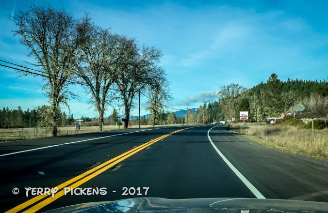
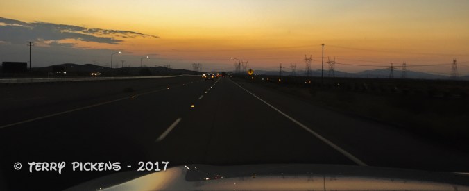
Next August my ADVENTURE will involve a 45 drive from Southern California to Dawson, Yukon Territories in Canada, up the Dawson highway to the Arctic Ocean and back in my 2017 Subaru Outback. It is something I have never done and it has always been on my bucket list. I have taken 2 cruises to Alaska and have loved the experiences. I now want to experience the lands of Canada and Alaska from the ground driving through the countryside.

2017-10-31 OverallMap

·      Will it be scary? …..Probably as I will be doing it alone.

·      Will it be exhilarating? …..Yes.

·      Will it be fun and exciting? …..Definitely.

·      Am I excited to plan and start this adventure? …..OH YES.

The trip will leave Southern California and head up east side of the Sierra Nevada Mountains then I will cut over to Vancouver, WA to visit my son and his family for a few days.

2017-10-31 CA2Van

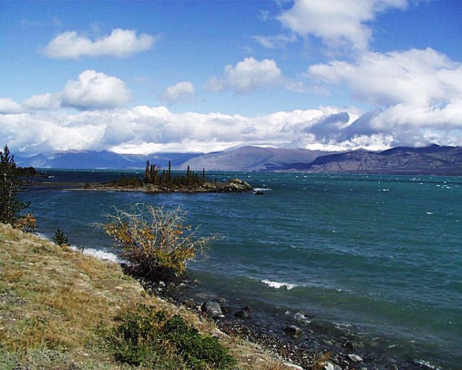
The Adventure really begins after this visit as I head to Glacier National Park, Montana; Waterton Lakes National Park in Canada. Continuing north to Banff and Jasper National Parks, Alberta, Canada. Then going north into the Yukon Territory, the smallest and least populated province in Canada to the small town of Dawson. From Dawson I will head up the Dawson Highway to Inuvik, Northwest Territories, Canada and then continue the final 130 km on the new all season road to Tukoyakuk, Northwest Territories, Canada. Returning to Dawson I will then head east to Chicken, Alaska turning south for Haines to cross on the ferry to Skagway, Alaska. It will then be time to head south after a few days rest in Skagway. Stopping again in Vancouver, WA I will hopefully finish with a camping trip in the Sierras with a group of Overland Bound friends to end this adventure. That is the rough itinerary at this time.

·      Adventure? …..I think so.

·      Something out of my ordinary routine? …..DEFINITELY for me.

So what does this involve? A lot of investigation on the Internet, reviewing maps and with the help from individuals who kindly share their knowledge of the areas I am visiting. I will be camping along the way when possible and staying at motels, hotels or lodges as needed. Road conditions, places to stay, services (food and gas), places to visit all need to be investigated.

·      Will schedules change?

·      Will additional sites present themselves?

·      Will destinations be revised?

All a YES to me, it is still being planned so anything is all possible.

My vehicle is still getting prepared for the adventure with items to makes it’s life and mine more enjoyable. Better suspension, all-terrain tires, roof rack, navigation equipment, full size spare tire, tow strap, tools, tire gauge, tire repair (plug) kit, gloves, fire extinguisher, shovel, axe, extra gas can, repair parts, extra power outlets added for charging all the electronic gear that we all carry now, tint for the rear windows, communications, boost jump starter battery charger and jumper cables, and a portable air compressor for a start.

w: Springs 1

My clothing and toiletries will be my normal travel items (see previous post) modified for the weather. I will possibly be adding a Go Pro video camera to my photographic equipment for additional documentation of the adventure.

Then I must go through the camping gear to pare down to the basics on what I really need to take along. It will include tent, tent ground cloth (footprint), sleeping bag and pad, stove, pots, fry pan, plates, cooking and eating utensils, dishpan, dish soap (Dawn), camp chair and table, tarp, mosquito repellant and head netting, camp lights and batteries, propane, lighter and matches, trash bags, cleaning bucket, 5 gallon drinking water container, a cooler and food storage containers.

Additional gear will include a hand held GPS, first aid kit, whistle, cordage (para-cord), knife, bear spray, maps, compass and possibly a small backpacking hammock.

Now what am I visiting along the way.

Part 1

The real start of my trip will be when I leave Vancouver, WA for Glacier National Park in Montana where I will be overnighting at the Apgar, Sprague Creek or Fish Creek Campgrounds depending on availability in the south end of the park.


From there I will head over “Going to the Sun Highway” to see the sights and stop as needed for the night.

2017-10-31 Glacier

The next day I will enter Canada and stop for a few days to explore the area of and around Waterton Lakes National Park.

After Waterton, I will head to Banff to stay for about 5-6 days in a condo (timeshare exchange) to explore the surrounding area. Along the way to Banff I will stop at the Bar U Ranch National Historic Site to look around.

2017-10-31 Glacier2Jasper

The fist day I will wander around the town of Banff getting current information at the Visitor Center and the Banff Park Museum, visit the Whyte Art Museum of the Canadian Rockies, the Natural History Museum and the Buffalo Nations Museum. Just outside of town I will visit Cave and Basin National Historic Site and the Upper Hot Springs.

In my remaining days in Banff I will explore up Highways 1 and 1A as far as Lake Louise visiting locations and scenic overlooks such as Backswamp, Muleshoe, Sawback, Hillsdale Meadows, Johnson Canyon, Moose Meadows, Silver City, Rock Lake, Castle Cliffs, Storm Mountain, Castle Lookout, Protection Mountain, Baer Creek, Outlet Creek, Corral Creek, Lake Louise and Moraine Lake. Returning at the end of the each days adventure to sleep in a nice bed with kitchen area. If the condo idea falls through I will just head north along those highways stopping at campgrounds along the way to Jasper, Alberta, Canada.

2017-10-31 Banff2LL

Now, how have I found this information? From maps; computer mapping programs; books, searching the specific areas I wish to visit on the Internet (Google is my friend); country, territory and city visitor information sites; and information from other travel bloggers. I have gone to my local bookstore to wander and peruse the shelves looking for interesting travel books of these areas. I will go to my local Automobile Association to find out what information they might have available there. A travel book, map and your time searching are well spent in preparing for a trip. Information gained ahead of the trip will help insure you plan the time to see the sites most important to you.

I will continue with the planning of this adventure in additional posts so please stay tuned.

Any ideas of what to visit in the areas I am traveling would be appreciated, not all sites are noted somewhere, secret spots abound. And if you share these secret spots with me to enjoy I will not post where they are but will relish in the beauty around me and be grateful you trust me with this information.

Grand Teton and Yellowstone National Parks trip, August 2017 Days 6 & 7

The Beartooth Highway is said to be one of the most scenic drives in the United States. Featuring breathtaking views of the Absaroka and Beartooth Mountains, high alpine plateaus, glacial lakes, forested valleys, waterfalls and wildlife.

Abutting Yellowstone National Park it sits in a 1,000,000 acre (404,686 hc) wilderness. Being one of the highest and most rugged areas in the lower 48 states, it contains 20 peaks reaching over 12,000 feet (3,657 m) in elevation. Surrounding mountain glaciers are found on the north-facing slope of nearly every mountain peak over 11,500 feet (3,505 m) high. The Road itself is the highest elevation highway in Wyoming and the Northern Rockies at (10,947 feet; 3,336 m) and in Montana at (10,350 feet; 3,154 m).

Breathtakingly beautiful this drive takes your breath away with the vistas and the driving along the curving mountainous roads. This road is not for the faint of heart as the steepness at the edges can be overwhelming for people who do not like heights. This is a road for driving, exploring and for taking your time to see all the sights and paths along the way.

Continue reading

Grand Teton and Yellowstone National Park trip August 2017 Day 5

Again leaving at 7:30AM we all head for the upper (northern) loop in the park heading clockwise to miss the construction traffic later in the day. We first want to visit the Mammoth Hot Springs area, then work our way back south. As we pass the major road construction project the wait was a little longer today and there was more of a line in front of us and behind us.

Is Mammoth Hot Springs drying up? No according to the National Park Service, it is in a constant state of change as the movement of water and fissures constantly changes underground. The Park Service estimates the amount of water emanating from this area has not changed, only where it issues forth.

Continue reading

Grand Teton and Yellowstone National Parks trip August 2017 Day 1

Day 1 Tetons iPhone-1

Early morning in the desert

Pocatello Best Western

Pocatello Best Western room

Blasting through Southern California, Nevada, Utah and entering into Idaho on my first day I arrive at the Pocatello Inn Best Western, Pocatello, Idaho for a nights stay after an 860 mile (1,384 km) 14-hour driving day. This very nice complex has a indoor pool and spa, seating area, free in room wi-fi and a buffet breakfast. When I arrived at 6 PM I was pleasantly surprised to find an Applebee’s Restaurant within walking distance of the motel to grab a small bite to eat for dinner.

Continue reading