After waking up and eating a good breakfast we continue north on Canada Hwy 97 and take a side loop road to Chasm Ecological Reserve. This canyon was carved by a stream 10,000 years ago at the close of the Ice Age. You can see the layers of lava in the walls of the chasm.
Along this section of Highway there are Mile Houses. These were so named because they are located that many miles from Lillooet (Mile 0) of the Cariboo Wagon Road. As the gold rush subsided, ranchers began to settle the surrounding areas and the towns held onto those names.
At the town of 100 Mile House, the worlds largest pair of cross country skis, as stated by the plaque in front, stand in front of the Visitors Center. 100 Mile House’s origins as a settlement go back to when Thomas Miller owned a collection of buildings serving as a resting point for the traffic of gold seekers moving north to the gold fields. It acquired its name during the Cariboo Gold Rush when a roadhouse was constructed in 1862 at the 100 mile (160 km) mark up the Cariboo Wagon Road from Lillooet.
And the first revision to the trip, it was decided to not stop at Barkerville and continue north. Barkerville shall be saved for a future adventure.
After passing through the large town of Prince George it was time to visit another site just off the highway, The Huble Homestead Historical Park.
Getting there right before to closing we had about a 1/2 hour to hurriedly walk through the Farmhouse, and Barn before looking around at the farm equipment in the fields surrounding the homestead. The farmhouse is a typical Ontario Farmhouse that took nearly a year to complete. Mr Huble later relocated and connected the old smaller family cabin to the side of the house to be used as summer kitchen. The house consists of a parlor, dining room, an office, a first floor master bedroom, and four upstairs bedrooms.
A barn, equipment shed and several small individual workers cabins surround the homestead.
Al Huble and Edward Seebach partnered to set up a business selling goods to trappers in the area and people passing through. After 10 years the business became so successful they built a false front General Store facing the river, painting it white to draw attention to it. This building, relocated closer to the Homestead Historical Park, served local land owners, travelers on the Fraser River and construction crews for the new Grand Trunk Pacific Railroad.
Continuing the northward trek, the nights campsite was at Crooked River Provincial Park along side Bear Lake. After setting up camp and having a quick bite to eat it was time for a stroll down along the lake shore to again be witness to a beautiful sunset.
Planning this adventure has been a 2 year ambition of mine. Last year life got in the way of the trip so this year it was a go. I got some interest from a few people that would like to tag along and one did show up at my house the day before departure.
Leaving early to get through the Sunday morning Seattle traffic the first stop will be the border crossing into Canada. After an easy crossing at the border we headed toward Abbotsford, British Columbia going north on BC 11 to Canadian Hwy 1.
The first section of the journey follows Canada Hwy 1 and the Frasier River. A 20-mile section of this road also includes 7 tunnels you must pass through.
Stopping at Hells Gate we elect to walk the 35 minutes down into the canyon instead of taking the Aerial Tram (Gondola). This abrupt narrowing of the river is located just downstream of Boston Bar. The rock walls of the river plunge toward each other forcing the waters through a passage only 35 meters (115 ft) wide.
The narrow passage has been a fishing ground for Local Native communities in the area for centuries. European settlers began to congregate there in the summer months to fish. This canyon became a route used by fortune seekers of Gold Rush miners accessing the upper Fraser gold-bearing bars and the upper country beyond. It was a dangerous passage where canoes didn’t dare its rapids. Ladders and shelf roads were constructed to get around its treacherous waters. Only one Sternwheeler successfully manuvered through this section of the canyon.
Continuing on Canadian 1 for a short time we decided to stop at Goldpan Provincial Park for the night. Finding a campsite along the river makes for an ideal location for the nights camp. After eating dinner it’s a short walk to the water to sit on the back with feet in the cool water and watch the sun set behind the mountain.
And this is what was heard in the tents all night long, what a sweet background noise to lull you into slumber.
After a restful nights sleep I make a small breakfast, pack up and head out for the short 1-hour drive across the Columbia River into Oregon for a visit to Fort Stevens State Park. Located in the far northwest tip of the state this park is bordered on 1 side by the mouth of the Columbia River and on second side by the Graveyard of the Pacific This 4,300 acre (17.4 sq km) park has much to offer to its visitors; walk or drive along the beach, hike coastal and forested paths, bicycle along bike trails, camp, beachcomb, birdwatch, visit a shipwreck, explore an abandoned military installation used during the Civil War and World War II. Or just relax and enjoy the area.
My first stop was to see one of the shipwrecks along this stretch of the Graveyard of the Pacific. Along with approximately 2,000 other ships since 1792, the remains of the Peter Iredale now rests on the sandy beach. Only a portion of this 275 foot (83.8 m) long steel ship remains, grounded where she came to rest in 1906 from a navigation error in dense fog by its Captain due to the areas treacherous weather and storms. It has become an attraction since the day it grounded on the sandbar.
Graveyard of the Pacific
Peter Iredale shipwreck. Coe photo.
Peter Iredale Shipwreck
Peter Iredale Shipwreck
Peter Iredale Shipwreck
Peter Iredale Shipwreck
Peter Iredale Shipwreck
Next stop was Fort Stevens. First built in 1863-64 during the Civil War it was in use up until the end of World War II, it was part of a 3-fort system at the mouth of the Columbia River to defend this waterway and ports from attack by sea. The other 2 forts were located in the state of Washington; Fort Canby at Cape Disappointment and Fort Columbia a few miles up river from Fort Canby. (For my visit to Fort Canby and Cape Disappointment see LINK)
View of Steam Plant, West Battery and Battery Pratt (from left to right)
Steam Plant Building
West Battery Command Station
View from West Battery Command Station
Replica gun of Battery 245
West Battery from Command Station
Top of West Battery
West Battery
West Battery
Battery Pratt
Replica gun on Battery Pratt
Lower Level of Battery Pratt
Ammunition Hoist inside Battery Pratt
Ammunition storage room inside Battery Pratt
Hoist Mechanism for Battery Pratt
Replica of 200 pound Parrot Rifle
Civil War era Battlemants
10 inch Rodman, smooth bore cannon
Protecting the waterway to the ports of Portland and Vancouver
Protecting the waterway from attack
Battery Smur
View from interior of range Finder Booth
Battery Clark
Inside of Battery Clark
Inside of Battery Clark
Artillery Engineers Room
During World War II a Japanese submarine fired upon Fort Stevens in June of 1942, making this fort notable as being the only military base on the Continental United States to be fired upon by an enemy since the War of 1812. 17 rounds were fired at the fort with no real damage being done.
After a full morning of exploring the buildings and small Fort Stevens Visitors Center – Museum I enjoyed a late picnic lunch and continued my journey south on Highway 101 to visit Ecola State Park. This 9 mile (14.5 k) long stretch of beach lets you enjoy hiking, picnicking, tidepooling, surfing and scenic coastal vistas. Located just north of Cannon Beach, OR I leave Highway 101 and travel the13 miles (21 k) of twisty narrow roadway into the north area of the park to see Indian Beach Day Use Area. This secluded beach is a spot frequented by surfers, beachcombers, and tidepool explorers and is reached along a short path down the hillside to the beach. Extending north is a network of trails that will provide a 2 ½ mile (4 k) loop trail to the top of Bald Mountain or continue north to Tillamook Head trailhead which is part of the Oregon Coast Trail. The loop trail is part of the Lewis and Clark National Historic Tail, walked by Lewis Clark and a band of men from the Corps of Discovery to search for a beached whale in 1806. They were hoping to return to Fort Clatsop with whale blubber as they fought hunger from their time there. They sadly return empty handed.
View from above Indian Beach, Ecola State Park
View from above Indian Beach, Ecola State Park
View from Above Indian Beach, Ecola State Park
Peaceful Indian Beach, Ecola State Park
Indian Beach, Ecola State Park
Indian Beach, Ecola State Park
Indian Beach, Ecola State Park
After this beautiful day of exploring I returned to my car and drove the 2 hours back to my home to plan the next trip in a few weeks, south to visit my family and friends at the home I just moved from.
Named by Captain John Meares’ 1778 disappointing sailing to find the mouth of the Columbia River for trading. Being turned away by a severe storm, he named this place Cape Disappointment. While in complete contrast Lewis and Clark’ s Corps of Discovery cheered as they completed their journey with their first sight of the Pacific Ocean on a bluff on Cape Disappointment.
Cape Disappointment State Park is far from being a disappointment. Steeped in Northwest history, it is a place to explore U.S. military and maritime installations, learn more of Lewis & Clark’s Corps of Discovery Expedition and their effects on native tribes of the area. Camp, fish, hike old-growth forests, roam around freshwater lakes, saltwater marshes and ocean tidelands. Marvel at the breathtaking views from the highlands above the sea and wander the beaches that are enjoyed by kite-fliers, beachcombers, sandcastle builders and those who just love to walk. Hike to 2 lighthouses that guided the mariners to the mouth of the river and kept them from becoming victims of the Grave Yard of the Pacific.
I began my day at the Lewis and Clark Interpretive Center and one of the Battery’s of Fort Canby that defended the entrance to the Columbia River from the mid 1900’s to the end of World War II. The Interpretive center is a museum providing a history lesson of The Corps of Discovery’s journey from settled America along the Mississippi River to the Pacific Ocean. Walk along the history path in its interactive exhibits that will entertain all ages. Sitting right above Battery Harvey Allen of Fort Canby to the inland side and overlooking the Pacific Ocean from its cliff side perch it is a wonderful place to start your visit to the park.
Battery Harvey Allen
Battery Harvey Allen
Battery Harvey Allen
Battery Harvey Allen
Battery Harvey Allen
Battery Harvey Allen
Battery Harvey Allen
Off to the south from the ocean-viewing platform of the Interpretive Center you see Cape Disappointment Lighthouse. Start the hike to the lighthouse in the Interpretive Center’s parking lot. You’ll walk through dense forest glimpsing ocean and river views as you make your way to the oldest operating lighthouse in the Pacific Northwest. Built in 1856 to warn the ships of the treacherous currents and obstacles of the river bar at the mouth of the river.
Cape Disappointment Lighthouse
On the walk to Cape Disappointment Lighthouse
On the walk to Cape Disappointment Lighthouse
Cape Disappointment Lighthouse
View of the mouth of the Columbia River from Cape Disappointment Lighthouse
Continuing on driving I thought I made a very wrong turn as I saw a sign for Waikiki Beach. It is a short ¼ mile (0.4 k) walk to the beach. It was still overcast when I visited although I suspect it would be a nice place for a picnic lunch and to watch the waters and vessels of the Columbia River float past.
Continuing my exploration of the park I stopped a short time later at the trailhead to Battery 247 that is perch on a hill in a strategic location overlooking both the Pacific Ocean and the Columbia River. Very deteriorated and overgrown it is an interesting structure to wander through. Although being small I recommend bringing some type of flashlight or headlamp to go deeper into the underground ammunition building. This is also the area where Lewis and Clarks Corps of Discovery first laid eyes on the Pacific Ocean.
Battery 247
Battery 247
Battery 247
Following the road a little further leads me to the campground. I wish to see if I wanted to spend the night here. I found it to be a nice place right along the ocean and went back to the entry station to reserve a site for the night. I wanted a quiet spot to relax for the night so selected site #157. My site is not right along the beach, although a few are, but only 200 yards (183 m) away. In this group of 9 campsites there were only 2 other sites being occupied.
Campsite for the night at Cape Disappointment Campground
Having settled my accommodations for the night I drove up to North Head Lighthouse to walk the pathway to the base of the lighthouse. This second lighthouse was built as the Cape Disappointment Lighthouse left a section of coast unprotected from a mariner’s point of view. Built 190 feet (60 m) above sea level in 1898 this 65’ (19.8 m) tall lighthouse is still functioning and maintained by the U.S. Coast Guard. This is located on one of the windiest places along the west coast with recorded winds of up to 120 MPH (321.9 km/h).
North Head Lighthouse
North Head Lighthouse
Finished for the day I returned to set up camp and have a snack before I took a walk along the beach outside my temporary front door. The beach was an easy walk although exploring higher up the high tide line finds many logs that have been deposited along the beach during the severe storms coming in off the Pacific. Many small windbreak structures have been built by visitors add to the cozy feel of the beach.
Storm tossed logs at Cape Disappointment Campground Beach
Storm tossed logs at Cape Disappointment Campground Beach
Storm tossed logs at Cape Disappointment Campground Beach
Visitor made wind breaks at Cape Disappointment Campground Beach
Cape Disappointment Campground Beach
Deciding to go back and grab my camera tripod, I return to the beach to watch the sun setting in the west. After a wonderful rest and watching a beautiful sunset I proceed back to my camp, fix a small dinner and climb into the tent early to do a little reading then to fall asleep listening to the waves crashing into the shore.
Sunset from Cape Disappointment Campground Beach
Sunset from Cape Disappointment Campground Beach
I will return here again to continue exploration of the trails in the area. The 1.5 mile (2.4 k) Coastal Forest Loop trail, Bell’s View Trail, the 1.5 mile (2.4 k) long North Head Trail and the south portion of the coastal Discovery Trail will be on the short list of walks.
I continue my journey in the morning crossing back into Oregon to visit Fort Stevens then head a little further south to see another fantastic beach.
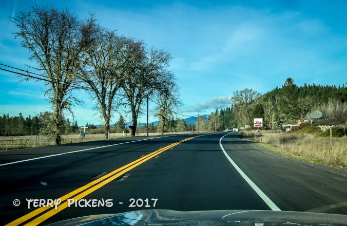
Excuse the lack of clarity in the photos and the videos; they were all taken with an iPhone 6 mounted to my windshield. The road was very bumpy and your looking through the very dirty windshield .
I was asked by my son to join him and 3 other friends to traverse the Barlow Trail on Labor Day weekend. I use the term Barlow Trail and Barlow Road interchangeably as the non-paved portion of this route is considered a trail on forest service roads.
What is the Barlow Road? Originally named the Mount Hood Highway this historic road/trail was the last segment of the Oregon Trail over the Cascades from Missouri. The opening of the Barlow Road in 1846, as a toll road, allowed wagons to pass over the landscape that was both rough and steep. This ended up being the most harrowing 100 miles (160 km) of the 2,170-mile (3,490 km) Oregon Trail between Missouri and the Wilmette Valley in what was then the Oregon Territory. The original overland portion of the Oregon Trail ended in The Dalles, Oregon.
The Cascade Range of mountains west of The Dalles at Mount Hood proved to be an insurmountable obstacle to early wagon trains. Surviving the journey from Missouri the settlers found The Dalles crowded by others awaiting the expensive and dangerous passage down the Columbia River. Barge operators floated the wagons down the river, the settlors walked along the banks of the river or drove their livestock over the high-elevation Lolo Pass of the Cascades. This was the only way to complete the journey until 1846 when Sam Barlow was authorized in December 1845 by the Provisional Legislature of Oregon to build a road. The road proved popular with more than a thousand immigrants and 145 wagons using it in the first year of operation. Only about twenty percent of the old Barlow Road is still visible today, the rest being covered over by paved roads and highways.
This segment of the Barlow Road, now known as Barlow Trail (NF-3530), is open to 4x4ers, bicyclists, hikers, and those with an adventurous spirit.
Leaving early in the morning to rendezvous with the others at a roadside rest area by Mount Hood in Oregon my son and I arrived a little late, the others were waiting as we fueled up for the 32-mile overnight off-road adventure.
Heading east along Highway 26 to Highway 35 we turned off on a dirt side road to find the entrance to the Barlow Trial. Before continuing we all stopped and aired down our tires for better traction and to give us a more comfortable ride on the dirt forest service road. Our speed would not be more than 20 miles an hour although more often than not at a 5-10 miles per hour.
Off to Wamic we go n our adventure.
Lunch stop
Turning left onto the road we stopped about 2-3 miles along under the trees for lunch. Sandwiches and snacks made, eaten and enjoyed we continued on.
At about 8 miles into the adventure we came to a bridge across a small river that was closed due to flood damage from a few years ago. Hikers and bicycles are allowed to cross but no vehicles are allowed. We went into the campground just before the closure to see if there was a way around or if we should just call it an early day and stop for the night. There is a way across the river but it is an illegal crossing and shouldn’t be used. As per Trails Off Road: “While there was once a crossing ….. the Motor Vehicle Use Map shows the crossing as being closed and all indications on the ground are that it is intended to be permanently closed. Further, the crossing itself is in a wilderness area. However, some 4x4ers still attempt the crossing illegally, damaging important natural resources in the process ………… Do not under any circumstances attempt the crossing. For those wanting to access the Keeps Mill Campground on the south side of White River, there are well-maintained roads coming from the south. Remember it is everyone’s responsibility to Stay on the Trail and Tread Lightly to protect our natural resources and help preserve access to our shared 4×4 trail system.” At the time we did not know this information but we all came to the conclusion this was probably an illegal crossing and we shouldn’t cross.
Deciding it was still too early we retraced our tracks then headed east on Highway 35 until we could reconnect with the trail on the opposite bank of the river.
Back on the trail we found a side trail that cut off to the north along the creek we had been paralleling. We drove in about a mile and found a beautiful creek side camping area to enjoy our evening. Fires were not permitted due to the high fire danger that the entire west was having so we sat around a legal propane fire pit one of the guys brought for a nice evening under the stars and a pretend fire. We all headed to bed rather early, bunch of old farts, and enjoyed listening to the stream splashing by us all night long.
Campsite
After a great nights rest we got up for breakfast. Having eaten and picked up my camp I looked around the area and noticed some large cat prints in the sand down by the creek just 20 yards from camp. A mountain lion had been down to the water sometime during the night as we all were asleep to have a drink. They were relatively fresh in the sandy mud and in the water so it must have come down early this morning before we got up. My son got a little nervous at that point as his 3-year-old son with us. The rest of the time we were there as he ran around camp, the forest and creek side there was one of the 5 of us keeping our eyes open and not letting him wander to far from us.
Continuing on after breakfast we still had a fair ways to travel.
Lined up for another break.
Upon completion of the trail a little after 1 PM and stopped at The Sportsman Bar and Grill in Wamic, OR for some nice big burgers before we all headed home our separate ways.
Heading north my son and I caught Interstate 84 at The Dalles and drove along the Columbia River until we crossed back into Washington on the Interstate 205 bridge. Arriving home right around 5 PM I unpacked the perishable foods from the cooler, showered and just rested until retiring for an early bedtime.
What a great time was had by all, it was great to finally meet this group of guys my son talks so highly about. I cannot wait to share some more adventures with them.
Well I am heading back out to Bickel Camp, Burro Schmidt Tunnel and a ranger led hike into Nightmare Gulch in Red Rock Canyon State Park for a fundraiser to help offset expenses on the upkeep of Bickel Camp.
Bickel Camp is full of mining equipment on display at this historic 1930’s era mining camp. The camp is still there to be visited by the adventurist explorer. Luckily this has remained on the “Adopt-A-Cabin” program and there is a caretaker on site to help explain and protect the remaining historic artifacts. Donations to help preserve and maintain the site are appreciated. 2 of Walter Bickel’s granddaughters were there walking us around the camp and telling of the fun they had out here when they visited. They told us one story of Bickel finding a stranded motorist in the desert and helped him get unstuck, turned out it was Jimmy Durante. Another interesting fact was that both Bickel and Schmidt were in the service during WWII, living within sight of one another they had a strong friendship and even rigged up automobile headlights so they could send messages back and forth in Morris Code. And yes the light at Bickel Camp is still standing.
For a full history on this wonderful place to visit follow this LINK.
Bickel Camp
Bickel Camp
Listening to the tales of Bickel Camp
Bickel Camp Equipment
Bickel Camp Equipment
Bickel Camp Equipment
Bickel Camp Equipment
Bickel Camp Equipment, tractor radiator
Bickel Camp Equipment
Bickel Camp Equipment
Bickel Camp Equipment
Bickel Camp Equipment
Bickel Camp Equipment, nice old Datsun 1600
Bickel Camp Equipment
Bickel Camp Equipment, old refrigerator anyone
Bickel Camp Equipment, homemade table saw
Bickel Camp Equipment has been here a long time
Bickel Camp Equipment
After wandering around the camp and being entertained by first hand stories from the granddaughters we all head the few miles down the trial to Burro Schmidt’s Tunnel to explore the hand-drilled tunnel nearly a half-mile long that was dug with a single 4-pound jackhammer, and dynamite.
For additional information see my previous post LINKED HERE.
Walking through Burro Schmidt’s Tunnel
Exiting Burro Schmidt Tunnel on the south side
Next up it was to find our way back to asphalt and turn south into Red Rock Canyon State Parkand the hike into Nightmare Gulch. We all meet-up for a short lunch stop at a park rest area before heading out the dirt road to the trail head. Although we did not do the loop we drove as far as we could to the official trail head and took a 5-mile total out and back hike into the canyon. Led by 3 Bureau of Land Management rangers we were given lessons in history, geology and ecology of this area. It was a great hike and took most of the afternoon.
Trail to Nightmare Gulch
Nightmare Gulch
Trail to Nightmare Gulch
Nightmare Gulch
Ranger led hike at Nightmare Gulch
Ranger led hike at Nightmare Gulch
Nightmare Gulch
Nightmare Gulch
Nightmare Gulch
Nightmare Gulch
Nightmare Gulch
Nightmare Gulch
Nightmare Gulch
Nightmare Gulch
Nightmare Gulch
Nightmare Gulch
Nightmare Gulch
Nightmare Gulch Pano
Leaving the trail head at about 4:30PM I still had a 3 hour drive home. Arriving home at 7:50 PM I was exhausted as I got up at 3AM to get there and meet someone at the turnoff to the Camp. This adventure was wonderful as I met new adventurers and discovered this magnificent canyon that I will return to to follow the entire loop trail.
The next few days were spent visiting with the family and friends I do not get to see that often. My son had made a plan and got together a few friends to go on a little adventure on New Years morning out to Tillamook State Forest about 40 miles west of Portland, OR.
This 364,000-acre (1,470 sq kilometer) forest is managed by the Oregon Department of Forestry and includes areas for campgrounds, hiking and backpacking trails, fishing, swimming, timber operations and interpretative center. There are trails for horses and pack animals, mountain bikes and motorized vehicles. This temperate rainforest averages more than100 inches (2,500mm) of rain a year and is considered one of the wettest areas of the United States.
New Years Eve we were the old folks and went to bed early as we were meeting everyone out there at 8:30 the next morning, so an early start from home was mandatory. Up at 5AM I showered (to wakeup) made a good breakfast and got my snack items and lunch for the day ready.
Arriving a little early we got a meeting spot at Browns Camp and were amazed at the number of people with the same idea. The staging area was filling up fast. Finally the last straggler pulled in, we organized everyone to communications, the general route and off we went with my son leading the way.
Heading up Firebreak Trail from the staging area and into the State Forest was great, the further back in we went the less people we encountered.
Finishing this short trail we head along Power-line Trail and we swing back onto forest service roads at University Falls to make our somewhat meandering way south to……
…..the fun Cedar Tree Trail where we drive under a fallen cedar tree, you don’t get to do that to often.
Back onto Forest service roads we meander north back to Browns Camp for a rest stop before our drive back home.
What a great way to start off the new year meeting new people, traveling this adventure with 10 other family filled vehicles and being out in the forest on a brisk but beautiful day. The 18 mile tail run was so much fun. Getting back home in the late afternoon we had dinner and relaxed for the night discussing what other adventures we should have in the next few days.
Up at 7AM in the dark, I showered, packed and departed to visit some painted ladies of the town. No not that kind, but the beautiful Victorian Houses located throughout the city of Eureka. My Air BnB host told me of Hillsdale Street and Carson Mansion as places to see fine examples of this Victorian, Queen Anne style of architecture.
These wonderful homes are located throughout the city in various stages of maintenance that go from restored to dilapidated conditions, along Hillsdale Street they are well maintained and are a great display of this style of architecture. Visiting Hillsdale Street lined with these homes brought back such a noustalgic past life that would have transported me back in time if it weren’t for all the modern cars parked out front.
Painted Ladies, beautiful Victorian Homes in Eureka, CA
Painted Ladies, beautiful Victorian Homes in Eureka, CA
Painted Ladies, beautiful Victorian Homes in Eureka, CA
Painted Ladies, beautiful Victorian Homes in Eureka, CA
Painted Ladies, beautiful Victorian Homes in Eureka, CA
Painted Ladies, beautiful Victorian Homes in Eureka, CA
Next stop was to have a breakfast consisting of 2 blueberry pancakes, 2 eggs, 2 pieces of bacon, hash browns and a large glass of orange juice to fuel my day of sightseeing along the California and Oregon Coast, yes I was hungry and finished it all. I planned to visit several scenic overlooks and lighthouses along the way to my next stop just north of Coos Bay, OR only 218 miles (350.8k) and 4 ½ hours of drive time north.
My first stop was still in Eureka, just down the street from breakfast, the Carson Mansion. Placed on the Historic American Building Survey in 1964 it is one of the most photographed Victorian homes in California. Completed in 1884 it has been a private club since the 1950’s.
Carson Mansion
Carson Mansion
My next stops, lighthouses in Trinidad, CA and Crescent City, CA were also recommended by Patricia, my B&B host.
Prior to satellite and electronic navigation sailors relied on dead reckoning, compass and visual sittings to sail the waters of the oceans, during the darkness of night they relied on the stars and visual sightings. Many ships were lost due to running aground due to heavy weather along dangerous coastlines.
Fires built on hilltops once defined port access and placing that fire on a tall platform increased its visibility out to sea. Later lighthouses were located along coastlines to help define the coastal shoreline and locate dangerous areas that could sink a ship. In heavy fog, that is quite common along coastlines, so a light and foghorns (bells in olden times) warned mariners of hazards.
California Coast
California Coast
Trinidad Lighthouse is only 20 miles from Eureka located on Trinidad Head a small section of land jutting south out from the coast defining the harbor entrance. Built in 1871 the small 20-foot (6.1m) tall tower sits on a promontory 176 feet (53.6m) above the sea. Originally consisting of the light tower, a single residence, and small barn; a fog bell house was constructed in 1898 with a 4,000-pound (1,800 kg) bell that was operated by weights. The Trinidad Civic Club erected a facsimile of the tower in 1949 at a park overlooking the harbor and installed the original lighthouse lens in its structure and the 4,000-pound bell displayed alongside the tower. This Memorial is now under protest by local Native Americans stating it has been built on an ancient burial ground.
Trinidad Head Lighthouse Trinidad, CA Photo form GOOGLE
Trinidad Head Lighthouse Trinidad, CA Photo form GOOGLE
62 miles (99.7k) north of Trinidad is the Lighthouse in Crescent City on Battery Point. This lighthouse built in 1855 is on a tiny point of land that is only accessible during low tide. Built in a Cape Cod style of architecture this lighthouse survived the March 27, 1964 Alaska earthquake tsunami that hit the city and killed 11 people.
Battery Point Lighthouse, Crescent City, CA
Battery Point Lighthouse, Crescent City, CA
Battery Point Lighthouse, Crescent City, CA
HAnging art at Battery Point Lighthouse, Crescent City, CA
Flotsam on the beach at Battery Point Lighthouse, Crescent City, CA
Flotsam on the beach at Battery Point Lighthouse, Crescent City, CA
Heading into Oregon I stop 35 miles (56.3k) north at Whaleshead Beach to walk along the sand and enjoy the coastal scene.
Whalesehead Beach, OR
Another 58 miles (93.2k) later I stopped at Cape Blanco Lighthouse at 3 PM. A lighthouse sitting on 200-foot (61m) high cliffs jutting 1-½ miles (2.4k) out into the Pacific Ocean, this forested head of land had to be cleared of the spruce forest so the light could be visible from sea. Getting out of the car was a struggle; the wind was blowing so hard I could barely stand up. Walking the ¾ mile or so path to the lighthouse along a ridge-line didn’t interest me today so I leaned against a pole just to get a steady photo of the lighthouse. I’ll return on a future trip to visit this one.
Cape Blanco Lighthouse, OR
The sea at Cape Blanco Lighthouse, OR
On the way in off Highway 101 I noticed a sign leading to the Hugh’s Historic House (Hughes Ranch) that is listed on the National Register of Historic Places, I decided to go in and see it, as I didn’t make the journey to the lighthouse. Situated behind a hill it was in the calm leeward side away form the strong ocean winds. Built in 1898 for the dairy farm of Patrick and Jane Hughes this Victorian style two-story house was home to Mother, Father and 7 children. Local church groups decorated every room for the Christmas Holidays. The well appointed home with authentic furnishings was a joy to walk around and listen to the curators tell of life of the inhabitants.
Hughes Ranch House
Interior DIning Room at Hughes Ranch House
Interior Kitchen at Hughes Ranch House
Interior Bedroom at Hughes Ranch House
Interior Bedroom at Hughes Ranch House
Interior Bedroom at Hughes Ranch House
Interior Bedroom at Hughes Ranch House
Finishing the day’s 218-mile (350.8k) trek in North Bend, OR I stop for the night at a Quality Inn Hotelat 5 PM to rest for my final push to Vancouver, WA the next day. A nice clean quiet typical motel room awaited me that evening for another great nights rest.
Getting up before dawn I left home in Orange County to head for my first nights stay in Eureka, CA. 682 miles and 11 driving hours from home. It was going to be a long day that took me up Interstate 5 to Interstate 580 through the east San Francisco Bay Area, up to Richmond and across the Richmond-San Rafael Bridge to link to Highway 101. This bridge is the northernmost east-west crossing of the bay. Opened in 1956 the tolls are only collected heading west.
Interstate 5 through the Central Valley of CA
RIchmond-San Rafeal Bridge
RIchmond-San Rafeal Bridge
RIchmond-San Rafeal Bridge
Connecting to Highway 101 I continue up this iconic road through the California Redwoods and my destination for the day Eureka, CA and a cozy room for the night.
Highway 101
I used Air BnB to locate this very comfy, quiet room with a separate entry and bath in a residential neighborhood in the south east of the city. Colorful Corner was all that it was advertised and the host Patricia was a marvelous person to meet. We talk via email before my arrival, she gave me suggestions for places to have dinner and to visit on my way north the next day. Along the way Patricia texted me that she might not be home when I arrived and gave me the access code to the room, Although when I did arrive, after 12 ½ hours of travel time, she was home and we had a delightful talk as I dropped my things in the room and headed out to dinner.
B&B
B&B
B&B
B&B
B&B
B&B
A port city on Humboldt Bay in Northern California, Eureka’s Old Town district and throughout the city features beautiful Victorian homes in all states of repair. The bay was overlooked by early European Explorers and not settled until 1849 when it was discovered by an overland expedition. The second largest bay in California was the jumping off point and base for the early gold miners of Northern California who did not want to take the long overland trip from Sacramento. Eureka got its name from the eager gold miners of the day, its Greek meaning “I have found it” is also the state motto of California. Timber, shipping, fishing, boating and a strong commercial district has shaped the largest coastal city between San Francisco, CA and Portland OR throughout it’s history and to this day.
The cool Mediterranean climate has an average high August temperature of 64.3 °F (17.9 °C) and an average December temperature of 47.8 °F (8.8 °C) With an average of 40.3 inches (1,024 millimeters) of rain per year falling on an average 119 days during the year. The city might also be covered in a blanket of fog for most of the year.
Climbing into bed, exhausted, I appreciated the warm, comfortable, quiet room and slept like a baby until the next morning.
2016 was just a total joke of a year and I was glad it was over, 2017 has been much better and full of adventures.
January started off recuperating from an sudden illness that happened in mid-December and during this time I started planning a trip up to Vancouver, WA the end of February to visit family and purchase my new adventure vehicle, a 2017 Subaru Outback.


You must be logged in to post a comment.