Alabama Hills, Lone Pine, CA

I had just an evening and a few hours the next morning to explore the Alabama Hills. I got in after dark and it was very windy and cold Halloween night so I didn’t want to spend too much time outside. I shall return with more time to explore the Movie Road and Movie Flats to find the locations of the arches and television / movie shooting locations. The Museum of Western Film History in Lone Pine will provide a history and has information and self-guided tours of the area.

Alabama-Hills-Movie-Location-Map

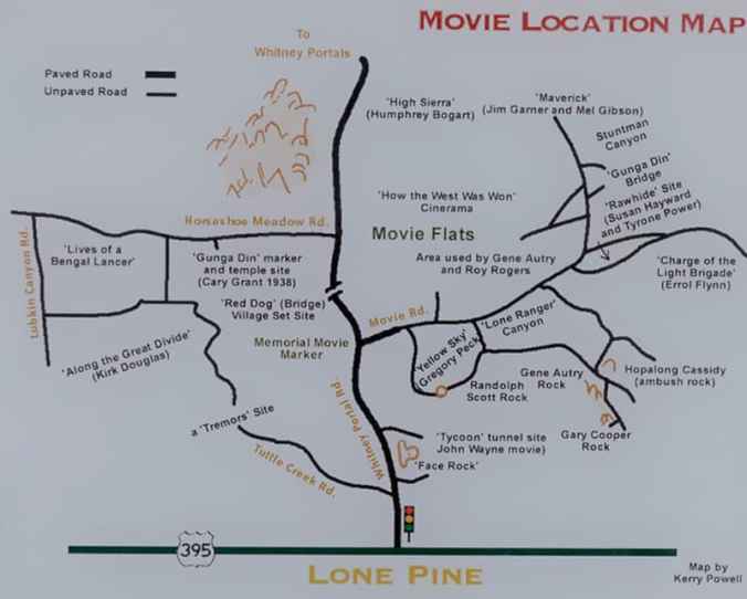
Map of several of the Alabama Hills movie sites

These hills, arches and rock formations on the eastern slope of the Sierra Nevada are in the shadow of Mount Whitney just west of the California town of Lone Pine. Located right off the road to Whitney Portal, the starting point for climbing the 11th highest peak in the United States and the tallest in California, this BLM land is open for exploring, hiking, astronomy, camping and exploring. The formations are part of the same geological formation although geographically separate from the Sierra Nevada Mountains just adjacent to the east

Mines in the area were named after the Confederate Civil War ship the CSS Alabama by sympathetic confederate miners of the time and then it became the name of the entire area. When the Alabama was finally sunk by the USS Kearsarge in 1864 the mining district, a mountain pass and peak and a town were named Kearsarge by sympathetic union miners.

Used by television and movie productions for filming, especially Westerns. Since the 1920’s this rugged environment has been shown in approximately 150 movies and a dozen television shows. A few of the early television shows have been Tom Mix, Hopalong Cassidy, The Gene Audrey Show, The Lone Ranger, and Bonanza. While Gunga Din, The Walking Hills, Yellow Sky, Springfield Rifle, The Violent Men, Bad Day at Black Rock and How the West was Won are some of the Movie Classics. Current Films have included Gladiator, Django Unchained, Iron Man, Man of Steel, Firefly and Tremors.

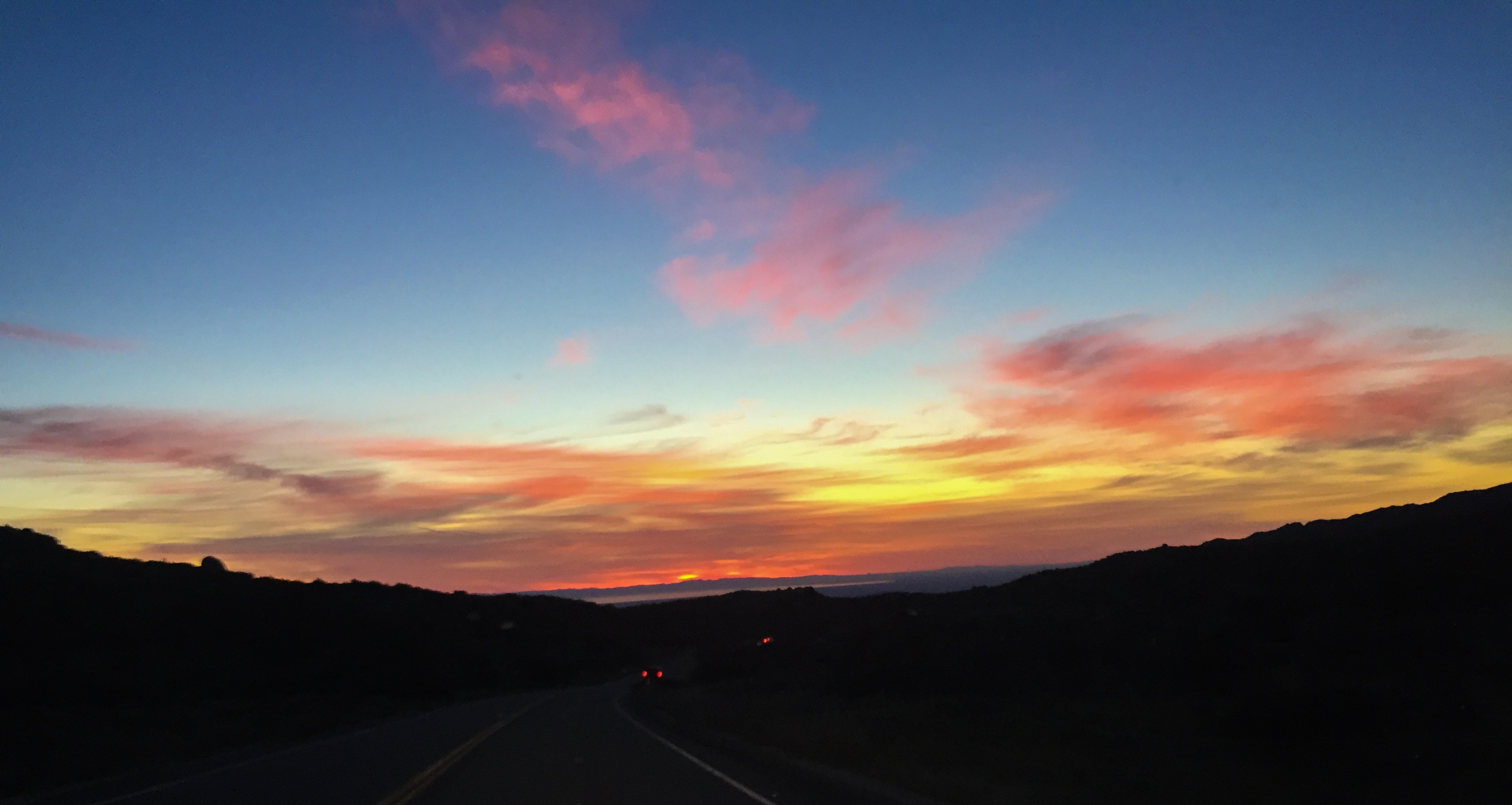
Nighttime is just as impressive as the landscape during the day as the Alabama Hills is a Bortle Class 2 “average dark sky” site. On a clear moonless night many star formations and the Milky Way appear brightly in the night sky.

January 27,2018 Bickel Camp Fundraiser


IMG_3425

Good Morning, 6:30 AM 28F degrees

Well I am heading back out to Bickel Camp, Burro Schmidt Tunnel and a ranger led hike into Nightmare Gulch in Red Rock Canyon State Park for a fundraiser to help offset expenses on the upkeep of Bickel Camp.

Bickel Camp is full of mining equipment on display at this historic 1930’s era mining camp. The camp is still there to be visited by the adventurist explorer. Luckily this has remained on the “Adopt-A-Cabin” program and there is a caretaker on site to help explain and protect the remaining historic artifacts. Donations to help preserve and maintain the site are appreciated. 2 of Walter Bickel’s granddaughters were there walking us around the camp and telling of the fun they had out here when they visited. They told us one story of Bickel finding a stranded motorist in the desert and helped him get unstuck, turned out it was Jimmy Durante. Another interesting fact was that both Bickel and Schmidt were in the service during WWII, living within sight of one another they had a strong friendship and even rigged up automobile headlights so they could send messages back and forth in Morris Code. And yes the light at Bickel Camp is still standing.

For a full history on this wonderful place to visit follow this LINK.


After wandering around the camp and being entertained by first hand stories from the granddaughters we all head the few miles down the trial to Burro Schmidt’s Tunnel to explore the hand-drilled tunnel nearly a half-mile long that was dug with a single 4-pound jackhammer, and dynamite.

For additional information see my previous post LINKED HERE.


Next up it was to find our way back to asphalt and turn south into Red Rock Canyon State Park and the hike into Nightmare Gulch. We all meet-up for a short lunch stop at a park rest area before heading out the dirt road to the trail head. Although we did not do the loop we drove as far as we could to the official trail head and took a 5-mile total out and back hike into the canyon. Led by 3 Bureau of Land Management rangers we were given lessons in history, geology and ecology of this area. It was a great hike and took most of the afternoon.


Leaving the trail head at about 4:30PM I still had a 3 hour drive home. Arriving home at 7:50 PM I was exhausted as I got up at 3AM to get there and meet someone at the turnoff to the Camp. This adventure was wonderful as I met new adventurers and discovered this magnificent canyon that I will return to to follow the entire loop trail.

2017 in review quite a better year

2016 was just a total joke of a year and I was glad it was over, 2017 has been much better and full of adventures.

January started off recuperating from an sudden illness that happened in mid-December and during this time I started planning a trip up to Vancouver, WA the end of February to visit family and purchase my new adventure vehicle, a 2017 Subaru Outback.

Continue reading

A short trip exploring desert mines

Location

As a trip I have taken on my motorcycle before I wished to explore the El Paso Mountain area at a slower pace and take my larger camera with me. This happened a few weeks ago and I had such a fun time exploring I will return again as there are so many additional sights that I could not visit in one day.


The trails took me from Red Rock Canyon State Park through the El Paso Mountains finally exiting close to the old gold mining town of Garlock. This west to east trail can be traveled in either direction and has many side trails leading to other areas.

Continue reading

A little day trip to Joshua Tree National Park

JT map

Park Map

At the end of May I decided to head out to Joshua Tree National Park to visit the Old Dale Mining District on BLM land that is located just outside the northeast portion of the park. Joshua Tree National Park is an environmental melting pot where 2 desert ecosystems meet, the Mojave Desert to the north and west and the Colorado Desert to the south and east. The Mojave Desert ecosystem consists of boulder stacks with pinyon pines, junipers and scrub oaks and the famous joshua tree. The Colorado Desert ecosystem in contrast consists of creosote, spidery ocotillo and jumping cholla cactus. Jumping cactus or teddy bear cactus got its name from the fact it tends to stick to anything within its range and is very painful to remove from the skin.

Continue reading

2008 Mojave Trail Adventure Ride

Me on my Honda

Me on my Honda

Now for an adventure that is totally different. This 2-day trek was completed in October 2008.

We started this adventure at a friend’s house in Silver Lakes, CA and ride to Laughlin, NV on the Mojave Trail and then end back in Silver Lakes the next day after an overnight in Laughlin.

Continue reading