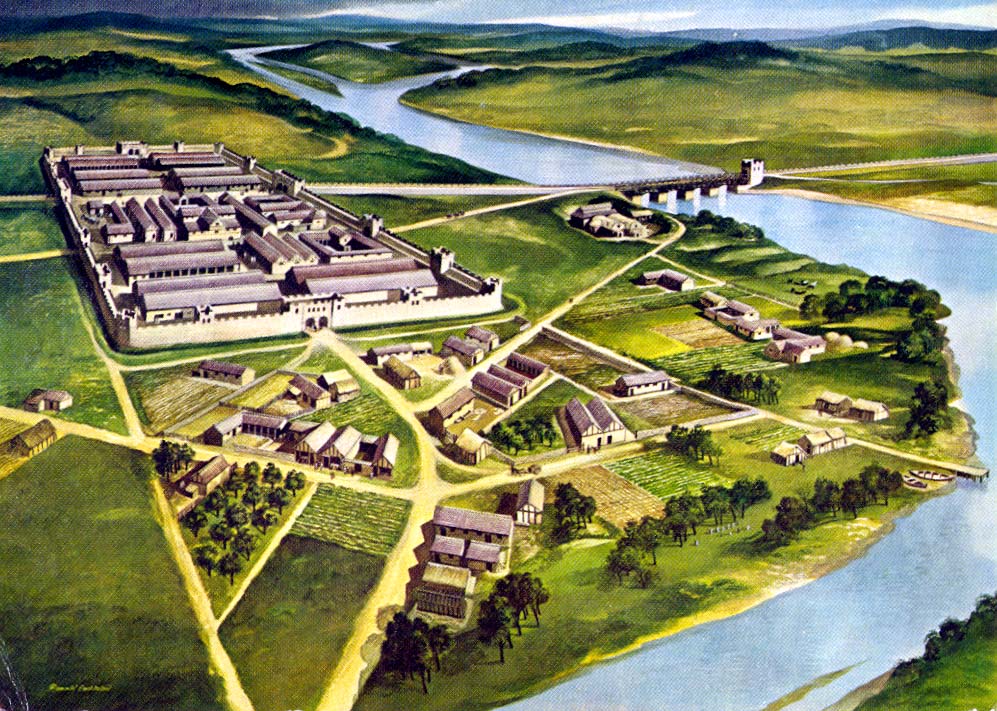
Chesters Fort Rendering from the south
After the morning wandering and exploring Beamish we drove approximately 30 miles to visit Chesters Fort (LINK) a part of Hadrian’s Wall (LINK). Driving along beautiful countryside we had to have the car disinfected for Foot and Mouth. Arriving at the fort we visited the museum to learn the history of the wall and fort, then walked through disinfecting mats for our short walk to the fort.


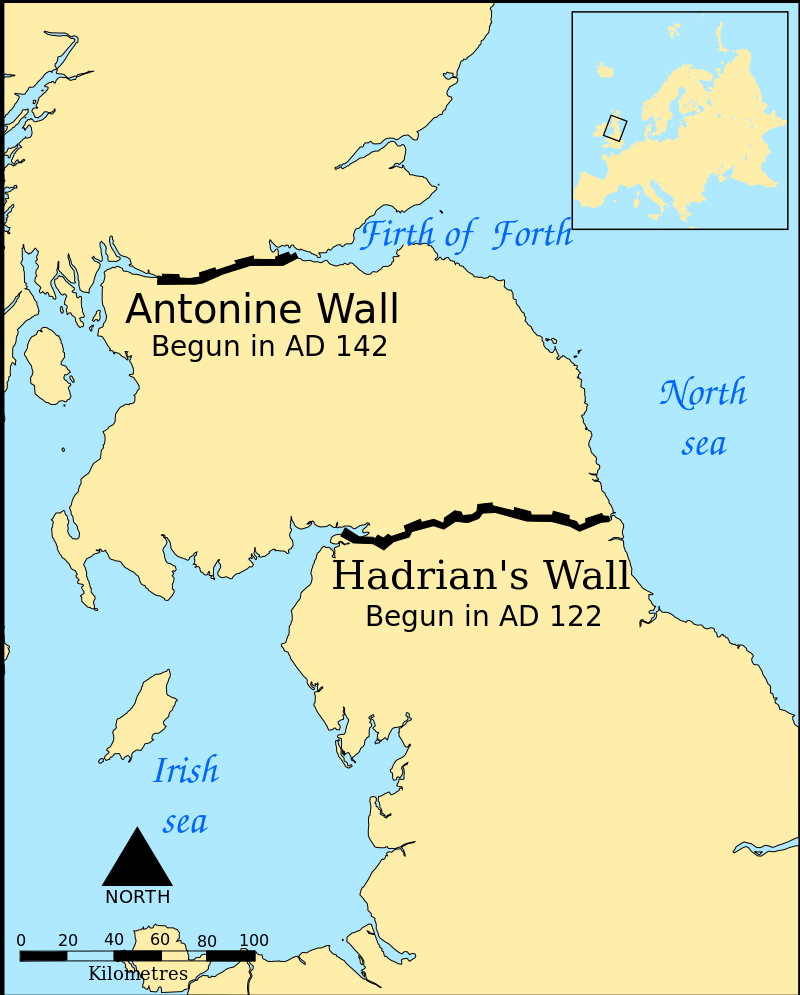 The Roman conquest of Britain began in AD 43 and by AD 100 the northernmost army units in Britain were along the Tyne–Solway isthmus. For 300 years Hadrian’s Wall denoted the north-west frontier of the Roman empire. By order of the emperor Hadrian in AD 122 the Roman army built this fortification as a defensive wall to protect northern England from northern barbarian raiders. It crossed 73 miles of northern Britain from Wallsend on the River Tyne in the east to Bowness-on-Solway in the west.
The building of Hadrian’s Wall probably took at least six years to complete. The final plan called for a wall of stone or turf fronted with a wide deep ditch with a guarded gate every mile (Milecastle) of a few dozen troops each, 2 observation towers between each gate and 14 forts, 7 1/3 miles apart consisting of 500-1,000 cavalry troops. The stonewall was about 15 feet tall and 10 Roman feet wide so soldiers could walk along the top. The turf wall was 20 Roman feet wide.


The forts were placed astride the Wall wherever possible thus allowing three main gates, each with two entrances, making the equivalent of six milecastle gates, to provide access to the north; the double-portal south gate was supplemented by two smaller side gates.
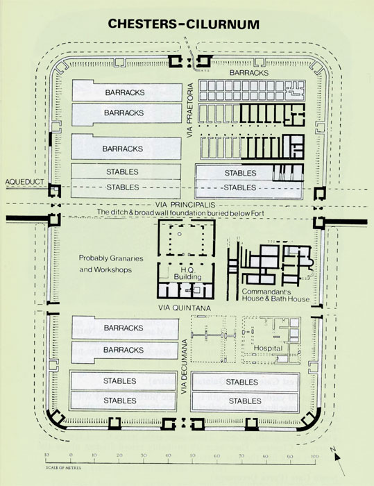
Built just after the wall was completed in AD 123, Chesters Roman Fort is the most complete Roman cavalry fort in Britain – wander the well preserved baths, steam room, and the officers’ quarters. Chesters Fort was built for retaliatory raids into the barbarian country north of the wall and also guarded Chesters Bridge that carried the Military Roman Road behind the wall across the River North Tyne. Sadly only the massive abutments of the bridge survive today.


Long sections of the wall were demolished by the local farmers and the stones used in the construction of roads and buildings in the surrounding area. In the 1830’s John Clayton started buying up some of the land on which the wall stood to protect it from farmers that were using the stones for building materials. In 1987 the wall was declared a World Heritage Site.
Hadrian’s Wall Path (LINK), dedicated in 2003, is a walking path along the length of the wall. If you are so inclined to walk the width of England, at this narrow section, expect to spend at least 7 days following the 84 miles of the path.


Walking among the 2,000 year old ruins was astonishing and an unforgettable experience. If you are in Northern England or Southern Scotland make sure to plan a visit to the wall and one of the forts along it’s length.
Upon leaving the fort we headed north to our next overnight and crossed into Scotland. At the border was a large stone marking the boundary and standing in front of the stone none other than a Bagpiper. Well we had to stop for a photo opportunity then continued on to Wakefield Bank our B&B for the night before we make our way into Edinburgh.


I’ve got a cousin in Scotland 🤓 and I know so little of this his/her story…always learn it best being there…wonderful educative post Terry…nice to see/read…have a good weekend ~ smiles hedy
LikeLiked by 1 person
See a reason to go visit. It is a wonderful country, so fun.
LikeLiked by 1 person